|
1. Overview
|
Name: |
The marshland at Brede Å and Vidåen |
|
Delimitation: |
Ribe to the north, Tønder
to the south, neighbouring entities Wiedingharde, Sylt, the northern
Danish mainland. |
|
Size: |
Approx. 48 x 10km |
|
Location
- map: |
South-western Danish
coastal area bordering the Wadden Sea |
|
Origin of name: |
Not known |
|
Relationship/similarities with other cultural entities: |
Embanked marshlands,
polders, mound villages as in Frisia |
|
Characteristic elements and
ensembles: |
The entity is dominated
by large embanked marshlands (some of the youngest Danish landscapes)
bordered by glacial hills (oldest quaternary Danish landscapes) and
sandy outwash plains. The only Danish polder landscape is located here
(Tøndermarsken) including the newest polder in Denmark (1982). There
are many examples of Frisian cultural elements among others the
remains of the most northern Frisian settlement in the Wadden Sea Area
(Misthusum in Ballum Marsh) and the largest mound village (Ubjerg).
The marsh town of Tønder with many gable houses and bow windows bears
witness of the close connection to the Dutch building tradition. The
entire area has through centuries been thrown backwards and forwards
between different Danish and German kings and dukes and from 1864 to
1920 the area belonged to Germany.
Linear geest edge settlement, dykes, prehistoric burial mounds,
sluices, bush groyne fields, ‘west Schleswig’ style farms and houses,
railway line. |

2. Geology and geography
2.1 General
The main geological elements are the marshlands (polders) stretching like
“tongues” between the glacial hill islands and the out-wash plains (together
named “the geest”).
During the last Ice Age (Weichsel) the ice cap only covered the eastern part
of Jutland. The moraine formations in the western part were created during
the second-last Ice Age (Saale) and thus constitute the oldest quaternary
landscapes in Denmark. Within the cultural entity
Hjerpsted Hill Island is
the most dominant example of this type of landscape.
The melting of the ice cap during the last Ice Age created large glacial
streams, which washed out over the southwest of Jutland. The low-lying areas
of the original moraine formations experienced erosion and were replaced by
the deposited glacial sand (out-wash plains). The highest parts of these
plains were left as islands (hill islands) and typically consist of moraine
clay with a sand and gravel deposit on the surface. The hill islands are
often dome-shaped with hillsides (cliffs) against the Wadden Sea (Emmerlev
Klev) and against the marshlands (Hjemsted at
Skærbæk).
Among the oldest Danish quaternary landscapes you will also find the
youngest, the sea-created marshlands. The marshland formations of the Danish
part of the Wadden Sea began approximately 3,000 years ago (from south going
north). The Tønder marshlands (Tøndermarsken) hold the only Danish example
of a centuries old and inhabited polder landscape, similar to those in North
Frisia. The first sea dike was established in 1556 (Højer-Møgeltønder polder)
followed by dike establishments in 1692 (Gl.
Frederiks Polder), in 1715 (Rudbøl
Polder), in 1861 (Ny Frederiks Polder) and in 1982 (Margrethe Polder). The
northern marshlands were not embanked before the 1900s: The Ballum Marshland
(Ballummarsken) in 1918 and the Rejsby Marshland (Rejsbymarsken) in 1925.
2.2 Present landscape
The salt marshes from
V. Vedsted to
Ballum
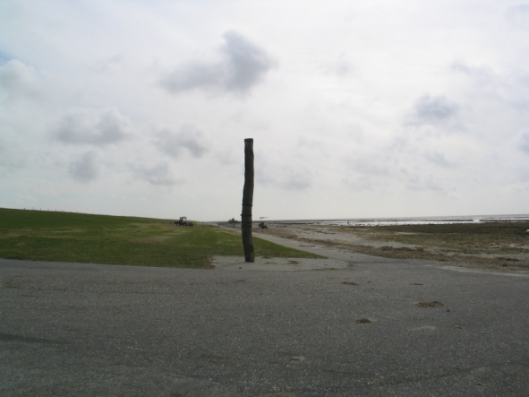
This area consists of a number of salt marshes along the Wadden Sea mainland
coast, delimited mainly by sea dikes and in many stretches by bush-groyne
fields in the Wadden Sea, which are there to enhance the creation of new
salt marshes in order to stabilise the sea dike. Between Astrup Banke and
the Rømø Dam there are well developed natural salt marsh formations. From
the sea dike there is a wide view over the embanked marshlands and the
Wadden Sea. The tidal dynamic in the landscape and the coastal protection
installations tell a story which is unique for Denmark.
The area holds many cultural remains. Apart from the sea dikes, the sluices
and the bush-groynes fields constitute the cultural history of the
marshlands from different time periods. Between the Rømø Dam and Astrup
Banke a summer dike is recorded (summer polder), which may be the northern
part of an old summer dike system in Ballummarsken. The actual dating for
this is, however, still lacking. The highest located parts of the summer
polder are in rotation with different crops and are perhaps the only area of
its kind in the entire Wadden Sea Area.
The embanked marshlands between
V.Vedsted and the
Rømø Dam
This area is formed by a long marshland between the Rejsby Dike and Toftlund
Hilly Island. The area appears as a homogeneous, level and open landscape,
without any buildings and technical installations. The villages along the
geest edge with their churches clearly mark the border between marsh and
geest. There is almost no tree growth, apart from some scrub along the many
drainage ditches in the area. The area has a number of artificial lakes in
the west as a consequence of clay extraction for the present reinforcement
of the sea dike. Several streams run through the area and pass the sluices
into the Wadden Sea, e.g. the Rejsby Stream and the regulated Brøns Stream.
The area is primarily used for agriculture with permanent grass and
cultivated crops.
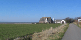
The glacial hill island and outwash plains between Ribe and
Skærbæk
The character of this landscape is dominated by agricultural use, with large
farms primarily for livestock. The farms are gathered in long ribbon
villages along the geest edge. Many of the villages are recorded from the
1200s and there are several old well-preserved farms. The location bears
witness to a thousand year old tradition for the use of two different nature
resources in the area: the wet pasture area of the marshlands and the dry
arable land on the hill islands. As the terrain is only gently sloping and
the fields are mostly only delimited by one row fences on two or three sides
the farm land appears open and level. The many landscape elements are in the
form of villages with older and newer houses, the varied size of the fields,
large farms, wind mills, hedges and smaller woods provide significant
variations to the landscape. In contrast, the area around
Vester Vedsted
differs from the surrounding area with large plantations, woodland and
hedges.
The Ballum Marshlands
Ballummarsken is characterised by being a vast embanked, open and level area.
It is delimited by the Ballum Dike and the geest at the town of Skærbæk. The
area is used solely for agriculture, with intensively cultivated crop and
grasslands. The location of the farms, the dwelling-mounds and the summer
dike are evidence of the long battle against the forces of nature, creating
an evident connection between nature and culture. Other characteristic
cultural historical elements are the Ballum Dike (1918) and the water mills
by Misthusum (1842).
 |
 |
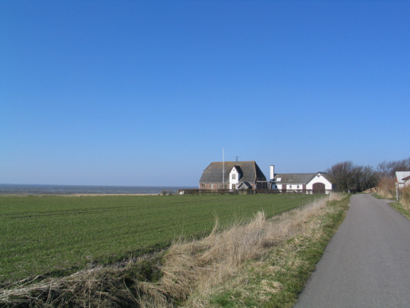
|
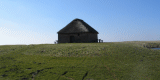
Misthusum , Ballum marsh: Markmandshuset |
with water mills |
Hjerpsted glacial hill island
The Hierpsted hill island is characterised by intensively cropped
agricultural fields delimited by hedges, smaller conifer forests and a few
larger plantations. The peripheral area of the hill island consists of
larger fields, where several villages are located. The buildings consists of
many large, and often old, well-preserved farms from the 1700s and 1800s,
many with large new extensions for livestock. The geest edge has, due to the
distinct contrast with the surrounding marshlands, a high cultural landscape
value. The area holds many prehistoric monuments, including settlements and
especially burial mounds. There are several large churches in the area and a
large wind farm north of the village of Hjerpsted. The town of Højer is
located on the southern tip of the glacial hill landscape and forms a
distinct transition zone to the bordering polders of Tøndermarsken.
The Tønder Marshlands (the outer polders)
This polder landscape is characterised by its plain, wide open features
without technical installations, divided by (former) sea dikes and dikes
along the large streams (Vidåen) into polders of different ages. The regular
pattern of dense drainage and watering ditches, dividing the marsh into
rectangular fenlands, is a unique feature in Denmark.
The Tønder Marshlands (the inner polders)
The inner marshlands by Tønder and Møgeltønder are delimited to the west by
the sea dike of 1556 between
Højer and
Rudbøl. The area is characterised by
its openness, and its embanked areas with large arable land. The area holds
many medieval dwelling mounds. The stream dikes are also important elements
in the landscape. These few, but important, elements provide the area with a
large scale appearance. There are only a few industrial installations,
including a few wind turbines, the high voltage connection from Højer to
Tønder and the railroad from Tønder to the border. To the south, the
wetlands around Vidåen and Rudbøl Lake form a contrasting area.
3. Landscape and settlement history
3.1 Prehistoric and Medieval Times
Since the beginning of the early Stone Age, approximately 6,000 years ago,
the area was permanently occupied in the form of scattered single farms
along the meadow on the geest. The many settlements and burial mounds are
examples of this, as at Abterp and Hjerpsted.
The combination of cattle farming in the marshlands and grain-growing on the
geest can be dated back to when the marshlands were created in the Bronze
Age 3,000 years ago. This fact can be derived from the dense concentration
of buildings following the geest edges, but also by the large amount of
burial mounds from this period e.g. by Hjerpsted. In addition, where the
hill islands reach the Wadden Sea, there has been a dense concentration of
buildings since the beginning of the Iron Age. The history of many of the
present villages can be traced back to the centuries B.C and several have
their origins as single farms in the early Stone Age or Bronze Age. Until
the 1000s the villages were often moved around, so continuous building can
not usually be traced at the same location, but instead within the same
natural resource area, today called association of house owners. In the
beginning of the Middle Ages most of the villages settled at a permanent
location, whilst the prehistoric villages are often found in the hinterland.
The fertile marshlands resulted in wealth for the area, and despite the
difficulties of navigation in the Wadden Sea, contacts with the west
European area can be traced back to the early Iron Age. A number of Iron Age
burials have been found in the coastal area e.g.
Hjemsted by
Skærbæk. The
trade links are evident both through finds in the burials and at the
settlements. The settlement of Dankirke near
Vester Vedsted has a special
position. Here traces from a manor, which probably played a central role in
the 500s and 600s in the trading of luxury goods from first the Roman and
later the Frankish area, have been found. In the burials from the 600s and
700s there are also items from the Saxon-Frisian and Anglo-Saxon area.
During the Middle Ages the inhabitants moved from the geest into the
marshlands.
In Ballummarsken, for example, settlement took place on small moraine
outcrops such as Mjolden,
Lunde and
Forballum. The later construction shows
a change in the use of the mounds, which artificially-elevated natural
hummocks. Further out in the Ballummarsken, the village of Misthusum also
shows some evidence of early habitation.
Misthusum is the most northerly
mound settlement in the entire Wadden Sea Region. In the Middle Ages eight
mounds were built here, and also a summer dyke, to protect against the less
severe storm-surges of the summer season. However, the village was inundated
several times during winter times and during the 1700s, the inhabitants
started to move onto the geest, and in 1814 the last family left Misthusum.
All that remains now are the remains of the summer dyke and the eight mounds,
including most of the freshwater reservoir (fething).
The Tønder Polders is the northern part of the large marshlands extending to
Husum in Germany. These were inhabited in the Middle Ages. At the location
called “Ved Åen” (along the stream) in
Møgeltønder Polder ten dwelling
mounds, originally located upon the former river levees of the old course of
the Vidå, can be seen. In this polder two of the three known wheels in the
Danish part of the Wadden Sea Area are located. In comparison to the rest of
the Wadden Sea Area the dwelling mounds are both small and recent. In the
Danish part, however, it is quite exceptional to have approximately forty
dwelling mounds within a relatively limited area, as can be found in Tønder
Marsh. Many of the mounds are no longer inhabited, but remain as proof of
mankind’s eagerness to exploit the fertile soil.
 |
Dwelling mounds in
Ballummarsken and Tøndermarsken |
The many channels in the area served both as boundaries and for transport,
with cargo carried in flat-bottomed marshland boats. The polders at Tønder,
Møgeltønder and
Højer were all embanked, with the construction of the
Højer-Rudbøl-Lægan-Grelsbøl (now in Germany) dyke in 1556. The effect of
this was that the old harbour town of
Tønder was cut off from the Wadden sea,
although sailing was still possible on the Vidå. In subsequent centuries new
embankments were regularly built, moving the coast and the course of Vidå
further and further to the west. The polder
Gammel Frederikskog was embanked
in 1692, Rudbøl Kog in 1715,
Ny Frederikskog in 1861 and finally
Margrethe
Kog in 1982.
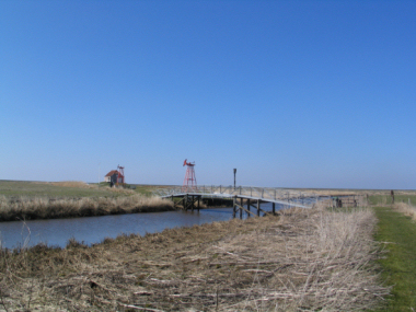
 |
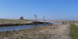
| Margrethe
Kog near
Vidaa sluice. |
Although all
the polders are part of the same development, each reflects different phases
of the exploitation of the embanked land. Behind the first embankment of
1556, the field structure is typical of the medieval irregular division of
the land. This is largely due to the old tidal gullies, which determined the
shapes of the fields. In contrast, the polders of 1662, 1715 and 1861 show
very regular divisions of the pasture-land. They were embanked through a
charter, tendered and contracted by the Danish king. The contractor could
invest their money in dike building and be granted a piece of land in return
in the new polder. The pattern of ownership can still be seen today from the
gates, which often carry the original initials of the owner.
Tønder – the mediaeval town
Tønder is the old market town of the entity and is first mentioned around
1130. It probably was founded as an anchor- and quay at the end of the Vidå
delta and acquired a municipal charter in 1243, which amongst other things
provided the town with privileges concerning trade and craft.
The extensive work on embankments and land reclamation in the middle of the
1500s cut off access to the sea, and Tønder lost its importance as harbour
town. Nonetheless it continued to be an important trading centre, especially
for grain and cattle. Later, trading in lace became very important for the
economy of the town, so that Tønder continued to be a significant trading
centre right up to the beginning of the 1800s. The historic town layout,
with its narrow gable houses facing the streets and the characteristic house
plan still dominates the town. Bay windows and portals set in two gated
doors are typical. While there are few remains of the old castle, Tønder has
preserved several of the brick-built houses of the 1500s and the 1600s. The
oldest, apart from the church, is the large grey gabled house on the market
square from the mid 1500s, the partially rebuilt watermill (Slotsmøllen)
from the 1590s, the grammar school from around 1610 and the Town Hall from
the 1640s.
Manors
Within this entity there used to be several private manors, in particular
around Højer and Tønder. The most notable were the castles of
Trøjborg and
Schackenborg. The history of Trøjborg can be traced back to the 1300s, but
all that remains today are the picturesque ruins of the Renaissance building,
which was demolished in the 1850s. The farm buildings from the 1700s and the
rampart have been preserved, and give a good impression of the construction
of the manor in the 1600-1700s. In contrast, the main building at
Schackenborg is very well preserved, but it lost its farm buildings as early
as the 1700s. The castle was known as “Møgeltønderhus” back in 1200s, when
it belonged to the Bishopric of Ribe. In the 1400s the estate was annexed as
a Danish enclave by the Duchy of Schleswig and, with the rest of the
Episcopal estate, it went to the crown during the Reformation. The royal
general Hans Schack was given the estate in 1661 by the Danish king as a
reward for long and loyal service. In the 1660s he commissioned the current
main building. The previous outer wall is still a part of the south wing.
The current appearance of the main building, with its hipped roof and the
rococo ornamentation on the side wings is the result of work in the 1700s.
Schackenborg is currently considered one of the most authentic examples of a
castle from 17th-18th centuries, and the street Slotsgaden towards
Møgeltønder is quite unique, with an extraordinary number of typical and
well-preserved houses from the 1700s and 1800s. These were built by the
owners of Schackenborg both to strengthen commerce and crafts in the town
and as living quarters for the estate workers.
Churches
The churches on the Wadden Sea mainland area are almost exclusively
Romanesque in form, and date from the 1100-1200s. They are generally bigger
than those immediately to the east and are typical expressions of the wealth
which the parishes along the marshlands enjoyed in the Middle Ages. It
should be mentioned that the church in
Brøns is one the largest Romanesque
village churches in Denmark and also the best preserved tuff church in South
Jutland.
Trade
A large part of the wealth in the Wadden Sea Area derives from the fattening
of and trade in oxen. The large stone-built stable from 1585 at the farm
Solvig by Tønder is a token of the importance of the ox trade; it was
probably build to hold the oxen in winter before they were sold to merchants
in the spring.
The market towns along the Wadden Sea had a monopoly in seafaring and there
were problems with regard to the larger vessels coming all the way into the
towns. Therefore, there were a number of outer embarkment places where the
goods could be reloaded onto smaller vessels.
In Tønder a sluice by Lægan was established when the 1556 dike was built,
and concurrently with the embankment more sluices were established to the
west. Seafaring was still important for Tønder, and in 1611 a canal was dug
through to the town to allow passage for smaller vessels. Larger ships were
put to and unloaded off Emmerlev, later the town of Højer became the harbour
place for Tønder. In 1736 Højer was granted a royal charter for commerce and
craftwork, thus becoming a so-called “flække” (market town), a type of town
particular to the Duchies of Schleswig and Holstein. From the end of the
1700s the town economy stagnated due to a decline in the market for oxen, as
well as the war with England in 1807-14 and the subsequent crisis. Several
attempts were made to revive trade, but with little success. Today the many
well-preserved and protected buildings testify to the town’s status as a
market town, including the high medieval church, the vicarage from the
1700s, the merchant’s house and Kier’s House from the 1760s and the mill
from the 1850s.
A peculiar industry within the entity was the production of lace. It started
slowly in the 1500s, and peaked at the end of 1700s. The big farmers and the
merchants of Tønder employed several thousand women and children in the
rural areas around Tønder who produced lace in their own homes.
3.2 Early Modern Times
The enclosure movement in the area took place more or less in the period
1762-1800, but not to the same degree as in many other areas of Denmark. Due
to the variety of natural landscapes represented (marshes, meadow, arable
land, heath and moor) it was more difficult to gather the fields of the
single farms. Therefore most farms stayed in the same location as before
with the same distance to their many fields. Around 1830 almost all farmers
of the area were freeholders. However,
Trøjborg and
Schackenborg still had
copyhold, the last part of which was sold in the late 1800s.
By the middle of the 1700s the golden days for the oxen trade were over and
the agricultural industry lost one of its primary exports. This also meant a
decline for several of the embarkment places in the area and for Højer as
harbour town, which despite several attempts had no success in promoting
alternative trade. Lace also lost ground as an export good in this period.
Building style
The entire entity, especially the southern part, is rich in brick-built
farms and houses in the ‘west Schleswig’ building style. In the early Middle
Ages, churches, castles and manors were brick built, however structures in
rural areas were not before the 1700s. This method of building was adopted
from the north German and Dutch areas where brick building had been
established since the 1600s. In west Jutland coastal areas the brick walls
were a distinct improvement, as they were much more durable compared to the
mud-built timber frames. A bricked house was also considered superior to a
timber-framed house. The bricks were made at small brickworks along the
entire coast and the lime produced by lime kilns where cockle and oyster
shells from the Wadden Sea were burned.
The Wadden Sea Area, in common with areas further to the north, has
four-winged farms which are “inside out”. However, the Frisian style, where
the stall and the living quarter are in the same wing divided by a crossways
hall, is much more common here than further north. Although the agrarian
buildings were influenced by contacts with Frisia, the Haubarg or Saxon
house (Fachhallenhaus) are not traditionally found in the area.
The farms are built of dark red bricks with hipped thatched roofs. Above the
main entrance is the characteristic gable with a hatch (the arkengaf), which
in this area and further south takes the form of a gabled attic. These
non-insulated houses are often tiled inside. In some of the houses on
Tøndermarsken dating from the 1700s, behind the outer brick wall,
roof-bearing posts have been preserved. In the latter half of the 1800s, the
agrarian architecture of the area was distinguished by the use of new
materials, and the reaction to this at the start of the 1900s through the
movements ”Baupflege” and “Bedre Byggeskik”. When the people of Bedre
Byggeskik sought the traditions of “the Danish house” they found that the
style of building in Møgeltønder was an exemplary model. Today, there are
several examples of Bedre Byggeskik along the entire Wadden Sea coast.
3.3 Modern Times
The Wadden Sea coast has undergone comprehensive changes through the
establishment of dikes, sluices and dams, regulation of streams and the
draining of the marshlands, since the end of the 1800s. The majority of
dikes in the Danish part of the Wadden Sea area originate in this period.
In the Tønder Polders, Ny Frederikskog was embanked in 1861, the last polder
embanked for agricultural reasons. The most recent polder, dating from 1982,
shows a different form of exploitation of the land as the main purpose of
the embankment changed from being a way of bringing more land into use to
being a way of protecting the inward-lying land. The creation of a reservoir
for inland water and a salt water lake for the loss of salt marsh habitats -
resulted in a landscape different to that of the polders behind. The new
sluice does not allow passage through and thus signals the very end of
seafaring for Tønder.
Tøndermarsken is characterized by the drainage work that took place in
1928-30. The landscape was considerably altered by the creation of the
embankment along the Vidå stream and the introduction of pumping stations,
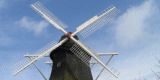
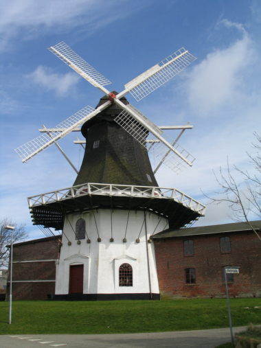
while at the same time the old wind mills previously used for drainage
disappeared.
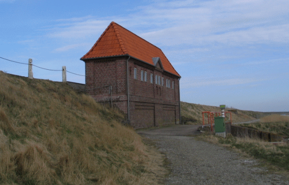
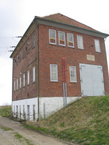 |
| Pumping station |
Today,
Tøndermarsken is the only Danish example of a polder landscape where the
traditional method of working (in the outer polders) is to a large extent
maintained. Also in an international context, the area holds great value
with regard to the cultural history and landscape assets.
In the early decades of the 1900s the northern marshlands were also embanked.
After the reunion in 1920, the sea dike was built between Vester Vedsted and
Astrup Banke. In 1918 the dike from Astrup Banke to Ballum was finished by
the Germans. At Ballum Sluice a sluice inn was built and the ferry to
Kongsmark on Rømø was moved here from the previous location north of the
present Rømø Dam.
Infrastructure
The Wadden Sea area has never been the centre of large-scale industrial
development. As in other parts of the country the infrastructure in the
Wadden Sea area was extended in the form of railroads and roads. The
Bramming-Ribe-rail opened in 1875 and the Ribe/Tønder-railway in 1887. In
addition, several smaller railways were opened, such as the one from Tønder
to Højer Sluice (1892), which amongst other things transported tourists to
the ferry connection to the island of Sylt. The passenger transport ended in
1935, transport of goods in 1962 and the station buildings were taken down
in 1985. Many traces from the railway can still be seen in the landscape
between Tønder and Højer.
Borders
The Wadden Sea area is a border region characterised by continual changes in
the borders and the rulers. The Wadden Sea coast from Ribe and north has
“always” belonged to the Danish Kingdom. The coast area south of Ribe is
historically part of the Duchy of Slesvig, with the exception of the so
called royal enclaves. The Duchy was formerly part of the Danish state, but
after the war in 1864 the area was included in Prussia. The new border
followed Kongeåen (north of Ribe), but farther to the west, the royal
enclaves were compensated, and therefore the area around Ribe belonged to
the King.
To increase the “Germanness” in the principally Danish-minded area, the
Prussian government began to buy up larger farms in 1896, which were often
expanded through purchases. These state-owned farms were leased on very
favourable terms to German farmers, who, in return, were expected to take
political and cultural initiatives to increase the “Germanness” of the
region. Most of these state-owned farms are to the east, and there are only
a few in the Wadden Sea region. One example is the farm yard “Røj” at
Møgeltønder, which was bought by the Prussian state in 1903, and where the
recent main buildings date from 1916. Later the farm was bought by
Schackenborg.
4. Modern development and planning
The towns in the area have only been influenced by industrialisation
to a limited extent, most obviously in Tønder when in the 1900s many old
houses disappeared in favour of new buildings and extensions of older
properties. The dock at Skibbroen was filled-in in the 1930s. In 1936 the
new military barrack in the northern outskirt of Tønder was opened. In 1940
the new by-pass road around the old town centre was finished. In the period
1900–1940s new residential neighbourhoods emerged, characterised by “Bedre
Byggeskik”. In 1963 “the Foundation for The Preservation of Old Houses in
Tønder”, in cooperation with Tønder Town Council, bought and restored a
number of old town houses.
Today, Tønder has several industrial enterprises of international importance
(Hartmanns Fabrikker, Norsk Hydro and the centre of the ECCO Shoes), but the
main trade is (cross border) tourism, which to a large extend has turned
Tønder into a busy commercial town. More than 30 Folk Festivals have given
the town an international reputation.
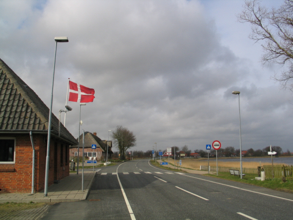 |
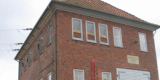
| Border station Rudbøl
|
In the other towns small industrial areas have developed, e.g. a spinning
mill and a slaughter house in Skærbæk and a carpet factory in Højer. ECCO,
which moved the last part of its shoe production abroad in 2001, has it’s
headquarter in Bredebro.
5. Legal and Spatial Planning Aspects
All the salt marshes and almost all the embanked marshlands are included in
the Trilateral Cooperation Area and are also part of Natura 2000. Moreover,
many (small) inland habitats like bogs, heathers and meadows are preserved
under the national Nature Preservation Act.
In 1988 the outer polders in Tøndermarsken were preserved by law in order to
secure both the natural, landscape and cultural historical values. In
addition, the preservation regulations of buildings (churches) and ancient
monuments (burial mounds) and their surroundings are common features in the
rural areas. Preservations and (strict) regulations in urban areas, e.g.
medieval town centres of Tønder and Højer have been in place for many
decades.
In relation to spatial planning, Denmark is divided into three zones: the
urban zone, the rural zone and the summer cottage zone, for which there are
different regulations to achieve different objectives and preferences.
In order to protect the coastal zone of Denmark, in particular, a three
kilometre wide protection zone from the coastline (outside towns) has been
introduced with the aim of keeping the area clear of buildings and
constructions which are not related to the coastal position. Moreover,
recreational facilities can only be located inside this zone in combination
with already existing facilities or urban areas.
It should be mentioned that the official policy states that no new areas for
wind turbines -and farms will be appointed, and that renewal of existing
wind turbines will only be allowed in the rural zone on special conditions
in relation to landscape and cultural features and assets.
From 2007 and onwards the main responsibility of the administration of rules
and regulations and the overall spatial planning will be located at the
three municipalities. Among other things they will be obliged to map,
designate and preserve the main cultural heritage and be requested to take
similar actions regarding the landscape features. Apart from this the
municipalities already have the powers to issue a “preservative local plan”
to protect specific and local cultural features.
6. Vulnerabilities
6.1 Settlement
The structure of the geest edge, hill island and outwash plain villages and
farming settlements are sensitive to development which does not fit with the
historic settlement pattern and to extensions in new building styles. The
historic town of Højer is characterised partly by a uniform building style
with old west Schleswig houses with thatched or tiled roofs. The town is
vulnerable to major changes which do not harmonise with the existing old
houses but the biggest threat is lack of maintenance. The area outside the
town centre appears neglected and the houses are threatened by decay and
possible demolition.
6.2 Agriculture
The area is vulnerable to agricultural intensification of existing farmland.
Further loss of grassland would be detrimental to the original character of
the marshland areas, stream valleys on the glacial hill island and outwash
plains between Ribe and Skærbæk. Changes to the traditional method of
working (in the outer polders) of Tøndermarsken would have a negative impact
on the historic landscape.
6.3 Natural conservation
The glacial hill and outwash plains between Ribe and Skærbæk, the marshlands
and peripheral areas of the glacial hill islands are vulnerable to changes
in historic character resulting from the establishment of forestry
plantations. The creation of new habitats e.g. salt water lakes can have a
detrimental impact on buried archaeological deposits and the wider historic
landscape.
6.4 Toursim
Tønder’s success as a tourist destination could put pressure on the cultural
landscape of the adjacent marshland.
6.5 Infrastructure
New technical installations would have a negative impact on the cultural
landscapes of the area, particularly in the salt marshes and embanked
marshlands.
7.
Potentials
7.1 Settlement
The rich historic building stock of the areas towns, villages and farms
provides opportunities for sensitive adaptation and re-use, to fit the
existing settlement pattern and character of the built cultural heritage.
7.2 Agriculture
Agri-environment schemes provide the opportunity to restore and maintain
areas of traditional extensively managed grassland, such as the wet
meadowland within the embanked marshes, stream valleys of the glacial hill
island and outwash plains between Ribe and Skærbæk. Any opportunity to
re-instate moorland fields on the Hjerpsted glacial hill island and grassed
areas on the inner polders of the Tønder Marshlands would also strengthen
the original character of the landscape and illustrate the connection
between the cultural historical origin and the natural foundation.
7.3 Management of cultural heritage
The rich cultural heritage of the area provides opportunities to preserve,
maintain and investigate features which will enable visitors and local
residents to consider, understand and experience its historical development.
Examples include the preservation and maintenance of individual bush-groins
fields in the salt marshes from V. Vedsted to Ballum; and the archaeological
investigation and dating of a possible connection between the summer dike in
front of Astrup Banke and the summer dike along Misthusum, which may shed
new light on the embankment history of Ballummarsken.
7.4 Nature conservation
The creation and enhancement of wildlife habitats could provide the
opportunity to integrate nature conservation management with the cultural
heritage in order to derive enhancement and positive management of both.
7.5 Tourism
The areas rich heritage, such as its prehistoric burial mounds, historic
landscapes and historic towns and settlements are rich for exploitation
through sustainable tourism. Tønder’s identity as the capital of the
marshland could be further strengthened in this way.
8. Sources
Author: Charlotte Lindhardt and John
Frederiksen
Sources: Lancewad – Landscape and Cultural Heritage in the Wadden Sea
Region, 2001 (Mette Guldberg)
1. Arbejdsrapport, Karakteristik af hovedtræk, Kulturarvsstyrelsen, januar
2006
2. Arbejdsrapport, Oversigt over kortlægningsemner. Kulturarvsstyrelsen,
august 2006
Maps: Kort- og Matrikelstyrelsen©
Photographs: Charlotte Lindhardt, Kulturarvsstyrelsen©
Cultural environments in the Southern Danish entity:
41: Hjemsted.
42: Skærbæk.
47: Forballum.
48: Ballum Vesterende.
49: Ballum Østerende.
50: Ballummarsken and Misthusum.
51: Ballum-Astrup Dige, Ballum Sluse and Ballum Slusekro.
52: Mjolden.
53: Burialmounds at Hjerpsted.
54: Hjerpsted.
55. Højer.
56: Højer Kanal, Højer Sluse and Højer Dige.
57: Tønder – the medieval town core.
58: Tønder – Vestbyen.
59: Tønder – Leos Allé.
60: Tønder – Ribe Landevej.
61: Tønder – the barracks and Carstensgade with the hospital.
62: Ubjerg.
63: Ved Åen.
64: Farms at dwelling mounds in the polders of Højer and Møgeltønder.
65: Ved Gaden.
66: Margrethekog, Det fremskudte Dige and Vidåslusen.
67: Emmerlev, Emmerlev kirke and Højkro.
68: Skast.
69: Trøjborg.
70: Møgeltønder, Schackenborg and domænegården Røj.
71: Brøns.
72: Zeppelinbasen and Soldaterskoven by Tønder.
73: Nørre Sejerslev, Vrågård and Sønder Sejerslev.
74: Rudbøl.
75: Sæd.
76: The Danish-German border of Sæd.
77: Nørremølle and Gammel Frederikskog
|