|
1. Overview
|
Name: |
Sylt |
|
Delimitation: |
Neighbouring entities Wieringen, Texel. |
|
Size: |
250
km� |
|
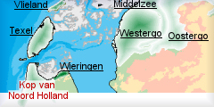
Location
- map: |
Province of Noord-Holland |
|
Origin of name: |
Most northern part of the province of Noord-Holland |
|
Relationship/similarities with other cultural entities: |
Connected with the entities on the mainland of Groningen and Frysl�n. |
|
Characteristic elements and
ensembles: |
Marshland, sea dykes and
polders. Open landscape, large water courses, (former) seawalls,
polders with large scaled rectangle field patterns, modern
fortifications, 'cloche' farmhouses. |

2. Geology and geography
2.1 General
The boundary of the Wadden Sea region of the mainland Kop Noord-Holland is
hard to define, but the southern boundary is taken to be the Westfriese
Omringdijk. This part of the present-day county of Noord-Holland first arose
after the last ice age. Following the period of Roman occupation the whole
of the northern part of the Noord-Holland peninsula became covered with a
layer of peat, with the hills of Texel and Wieringen rising above this
fenland area. The protective barrier island, which was probably inhabited,
lay a few kilometres to the west of the present coastline. The fens drained
in an eastwards direction via the Marsdiep channel, which was then a
tributary of the Vlie.
 |
 |
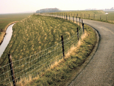
| Photo: Dyke in Kop Noord-Holland (Krabbendamm)
|
Dykes in Kop Noord-Holland |
2.2 Present landscape
The area is divided in two parts, the western portion comprising sand and
sand-dunes, whilst the eastern part is marsh. The marsh is characterized by
dykes and waterways.
3. Landscape and settlement history
3.1 Prehistoric and Medieval Times
Evidence for occupation of the area in the Neolithic period can be found on
the headland of the Noord-Holland peninsula, e.g. in the Groet Polder and in
the Zijpe en Haze Polder. These Neolithic sites contain the remains of
settlements of the Funnel Beaker culture and the Single Grave culture and
are exceptionally important because they reveal adaptations made by the
inhabitants to the marine environment. The condition of the finds are so
special that Groet Polder is being considered for nomination to the World
Heritage List. The fens were subsequently occupied by people moving in from
the surrounding areas during the Merovingian period (c. 450-700 AD),
including the present islands of Texel and Wieringen , as well as probably
from the area to the south of Rekere (which has now disappeared beneath the
sea). The first settlements in the fens, which date from this period, were
located along the Marsdiep channel, the Rekere and along the fen river
Middenleek in the vicinity of the modern town of Medemblik. In the
Carolingian period the settlements in the area were concentrated in four
main locations: on Texel, on Wieringen, in northern West-Friesland (between
Andijk, Schagen and Medemblik) and a smaller concentration in the area
around Den Helder.
At this time Texel was still linked to the mainland (is this a correct
interpretation ?). The barrier island between Bergen and Texel was only
breached later by the Zijpe, the Heersdiep channel and a tidal inlet to the
south of Texel, which would later link up with the Marsdiep channel. This
gradual erosion was due not only to the rising sea level, but also partly as
a result of human actions. The inhabitants moved into the fenland from the
higher ground in order to reclaim it for arable farming. By draining the
peatland, they set two processes in motion: the lowering of soil-levels and
the oxidation of organic remains within the peat. These two processes led to
a rapid lowering of the ground level, which made it easier for the sea to
penetrate into the area. Eventually, in the area between the two tidal
inlets, mainly to the west of the present coastline, only two islands
remained: Callantsoog and Huisduinen.
3.2 Early Modern Times
During the sixteenth century the inhabitants of Kop van Noord-Holland
were able to construct more sustainable dikes. They experimented tirelessly
with draining polders and a considerable area of land was reclaimed from the
sea. During this period the top of the Noord-Holland peninsula was a tidal
flat; large quantities of sand were washed in through the inlets and
deposited over the area. In Koegraspolder, these sand deposits are still at
surface level.
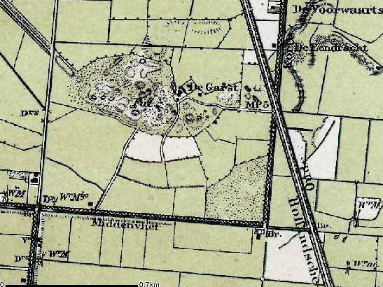 |
Map with
location of sand deposit |
In the sixteenth century the Zijpe and Heersdiep inlets silted up, but the
Marsdiep channel remained open and became wider and deeper. The Marsdiep
became an increasingly important channel for marine activities and was
therefore of strategic significance, as evidenced by the construction at
this time of fortifications on both sides of channel.
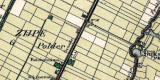
Various attempts were made to reclaim the tidal flat behind the Zijpe
inlet. This was finally achieved in 1597 after which more than 6500 hectares
of sandy soils in the Zijpe and Haze Polder were improved for agricultural
use.
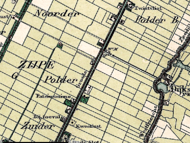 |
 |
| Zijpe and Haze Polder
|
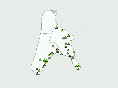
Location of historical farms |
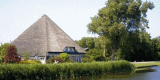
Farms were
built along three routes through the polder. The most impressive of these is
the eastern axis, the Groote Sloot canal, with its fine examples of
farmhouses with pyramid-shaped roofs, the so called 'cloche' farmhouses (stolpboerderij).
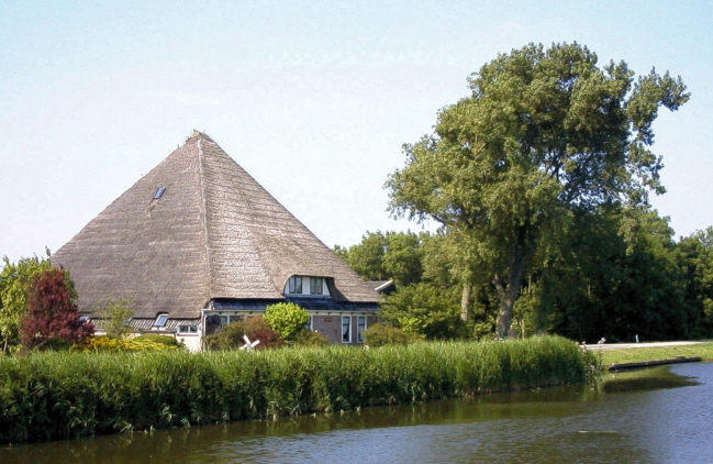 |
| Photo: A so-called 'cloche'
farmhouse (stolpboerderij) |
3.3 Modern Times
The Noordhollands Canal, built in 1819?1825, fits perfectly into the
landscape pattern of the Zijpe and Hazepolder. The Koegraspolder lies to the
north of the Zijpe Polder. The dikes surrounding this polder were built in
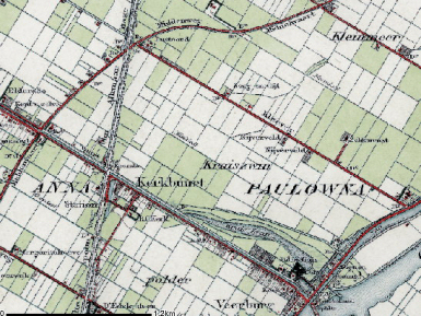
1817, just before the construction of the canal. The Anna Paulowna Polder
was reclaimed in 1847, just after the canal was finished. Both these polders
are divided up into regular parcels. The Waard- en Groet Polder, reclaimed
in 1844, presents the same picture.
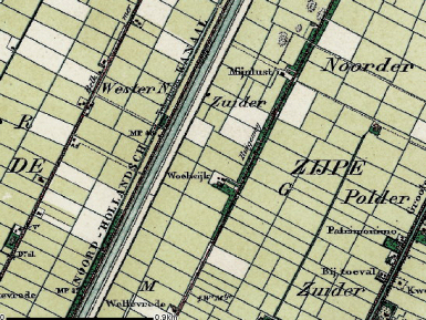 |
 |
| Noordhollands Canal in the Zijpe and Hazepolder |
Map of Anna Paulowna Polder
|
TThe
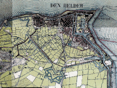
fortress of Helder, now Den Helder, a naval port since 1781, lies on the
most northerly tip of the area. During the Anglo-Russian Invasion of 1799,
part of the French Revolutionary Wars, Den Helder was controlled for a short
period by the allies. The coastal defense batteries overlooking the Marsdiep
were the only sizeable weapons to defend Den Helder, the invasion therefore
took place from the landward side.
|
Map of
Den Helder with fortress |
 |
During the
period when The Netherlands were part of the French Emprire (1810-1813),
Napoleon Bonaparte decreed that a ring of forts should be constructed and
the coastal batteries extended to the south. This fortified ring, which
includes LaSalle (Erfprins), Morland (Kijkduin), l�cluse (Dirks Admiraal),
Oostoever (orig. Dugommier) and Westoever forts, is unique and forms an
important element in the international heritage of Europe.
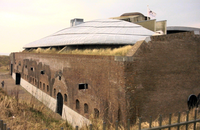 |
| Photo: Fort Morland (Kijkduin) |
4. Modern development and planning
4.1 Land use
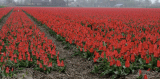
The large fields in the relatively young polders still contain high
quality agricultural land and farming remains the primary land use to this
day. Most of the land is used to cultivate bulbs. In the spring the
extensive fields of flowering bulbs attract large numbers of visitors, many
of them from abroad.
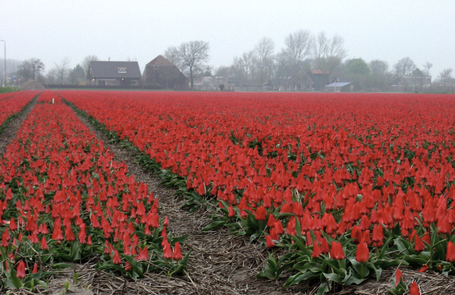 |
| Photo: Tulip field in Kop van Noord-Holland |
4.2 Settlement development
The biggest settlement in this area is Den Helder. In the 1990?s
international agreements and the fall of the iron curtain led to large-scale
unemployment for Den Helder and the adjacent region. New economic
opportunities must deliver new jobs in the near future.
4.3 Industry and energy
The largest part of the area is used by agricultural industries but other
important industries include tourism, fishing and the naval base.
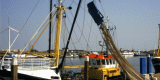
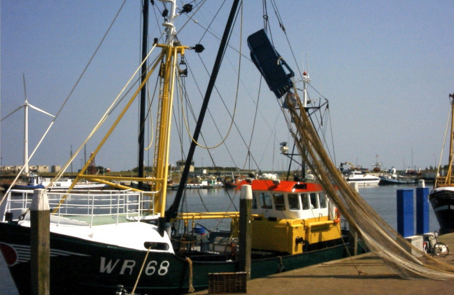 |
| Photo: Harbour of Den Oever |
4.4 Infrastructure
The infrastructure of Kop Noord-Holland is connected by two main roads and
one railroad. All the roads come together in Den Helder. Only the ferry to
Texel departs from Den Helder.
5. Legal and spatial planning aspects
The Legal and Spatial Planning Aspects are described in a general way, as
these are relevant to all the cultural entities in the province of Noord
Holland. Due to the scale of the entities (which cover more then one
municipality), the focus is on regional policy and management. However, the
goals of the regional policy and planning strategy are taken into account by
the local sector planning policy. The regional goals and strategies are
formulated after discussion with a wide range of stakeholders and
organisations.
In October 2004 the Province of Noord-Holland adopted the Development
Perspective of the sub region Noord-Holland-noord within the framework for
regional spatial planning. Agriculture continues to be the primary function,
with opportunities to develop in scale and in new directions, but with
regard to maintaining the quality of the landscape and cultural heritage of
the area. In particular the expansion of flower bulb cultivation is
considered to be important. In a large part of the area wind energy is
regarded as a favoured means of energy production. Housing and industry can
be developed in a concentrated way at selected locations, again with due
regard to the landscape and cultural heritage. Den Helder will keep its
naval identity.
The implementation of the Valletta treaty is likely to enhance aspects of
heritage within the planning policy process. As a consequence,
archaeological assessments or evaluations will be compulsory for most
development plans.
6. Vulnerabilities
6.1 Settlement
Expansion of settlement is a threat to the existing settlement pattern. The
sky line of the settlement and the historic core at Den Helder, and its
naval identity are vulnerable to new development.
6.2 Agriculture
Intensification and expansion of the bulb growing industry is a potential
threat to below ground archaeological deposits. The industry requires large,
flat land parcels, and its expansion could also lead to the loss of field
boundaries and other historic landscape features.
6.3 Industry and energy
The visible historic landscape is vulnerable to the expansion of wind power
which could significantly alter the visual amenity of the wider landscape.
Only carefully located and designed concentrations of wind turbines (e.g.
around Den Helder) should be allowed. Construction of wind turbines could
also lead to the destruction of below ground archaeological remains.
|
7. Potentials
7.1 Settlement
The tourism sector can exploit the historic settlement pattern by
promoting the use of former farm houses and villages for tourist
accommodation. New developments within Den Helder should take the
opportunity to maintain the historic skyline and enhance the
historic core of the naval port.
7.2 Agriculture
The robust structure of the landscape can accommodate agricultural
change which does not generally affect the characteristic openness
of the area. The careful expansion of agriculture should provide
opportunities to manage the historic landscape and buried
archaeological deposits in a sustainable manner.
7.3 Tourism
The area has a robust landscape structure of large water courses and
former sea walls which could be utilized to enhance visitor access
to the landscape and cultural heritage, including its prehistoric
settlements, early modern land reclamation, historic farmhouses and
existing agricultural landscape. This could be achieved through the
development of cycle and walking routes, and the use of historic
waterways, providing visitors with the opportunity to combine
appreciation of both the natural environment and the historic
landscape.
7.4 Maritime history
Den Helder's naval history and the Napoleonic fortifications of the
area are of great importance and ideal for further promotion to
tourists and to the local inhabitants and workforce.
|
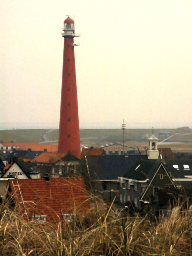
Photo: Lighthouse in Den Helder |
|
8. Sources
Marrewijk, D & A.J. Haartsen, 2002, Waddenland Het landschap en cultureel
erfgoed in de Waddenzeeregio, Ministerie van Landbouw, Natuurbeheer en
Visserij / Noordboek, Leeuwarden
Provincie Noord-Holland, 2004, Ontwikkelen met kwaliteit, ruimtelijke
samenhang op uitvoeringgericht, (streekplan) Ontwikkelingsbeeld
Noord-Holland Noord. Haarlem
|
|