|
1. Overview
|
Name: |
Lauwers |
|
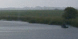
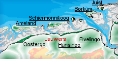
Delimitation: |
The
Lauwers region is located in northeastern Friesland and northwestern
Groningen. The area consists of marine clay polders in the flood
plains area of the River Lauwers and the former Lauwerszee, part of
the Wadden Sea. |
|
Size: |
around
310 km² |
|
Location
- map: |
Province of Fryslân and Groningen |
|
Origin of name: |
Named after the river Lauwers |
|
Relationship/similarities with other cultural entities: |
Middelzee and Fivelingo, also former estuaries. |
|
Characteristic elements and
ensembles: |
Land reclamation: open
wetland with dykes, surrounded by earlier reclaimed land. Former
fishery villages, dyke villages, dwelling mounds, sluice villages,
rivers and waterways. |

2. Geology and geography
2.1 General
Lauwers is sited on the northern side of the boulder clay plateau known as
the Drenthe Plateau, where a low-lying area was created by erosion where the
Lauwers River flowed through the region. At the end of the last Ice Age the
climate became warmer and more humid, leading to the melting of the ice caps
and a rise in the sea level. Groundwater levels rose at the same time,
leading to the formation of swamps in parallel with the former coastline, in
which peat formed. The continuing rise in sea level, combined with the
deposition of silts, obstructed the formation of clay on the seaward side,
whilst the peat-bog extended ever further inland. In the early Middle Ages
the sea penetrated into the land ever more deeply and large tracts of peat
were washed away. The mouth of the Lauwers was scoured out to form a broad
estuary known as the Lauwerszee. Clay walls or natural levees developed
along the rivers. With the subsidence of the peatlands on the other side,
these levees came to assume a considerable height. In many areas these were
subsequently cut away for brick production. In areas where the peat was not
eroded away, marine clay was deposited on top of the peat. Part of these
salt marshes and clay-on-peat areas were empoldered, thereby reducing the
size of the Lauwerszee. In 1969 a barrier dam was constructed, putting an
end to this inland sea.
 |
 |
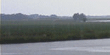
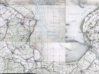
| Old map of Lauwerszee |
Dykes in Lauwers |
2.2 Present landscape
The landscape is of an open arable land with dykes, which together with the
field patterns tell the story of land reclamation. The heart of the entity,
the former estuary of the Lauwers is still a wetland.
3. Landscape and settlement history
3.1 Prehistoric and Medieval Times
The Lauwerszee has been in existence since the 7th-8th century. Until
the 11th century most of the area comprised this inland sea. Many rivers
like the Lauwers and the Reitdiep discharged their water in the sea.
Inhabitants of the surrounding areas used the water for fishing and
transport.
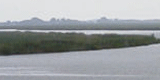
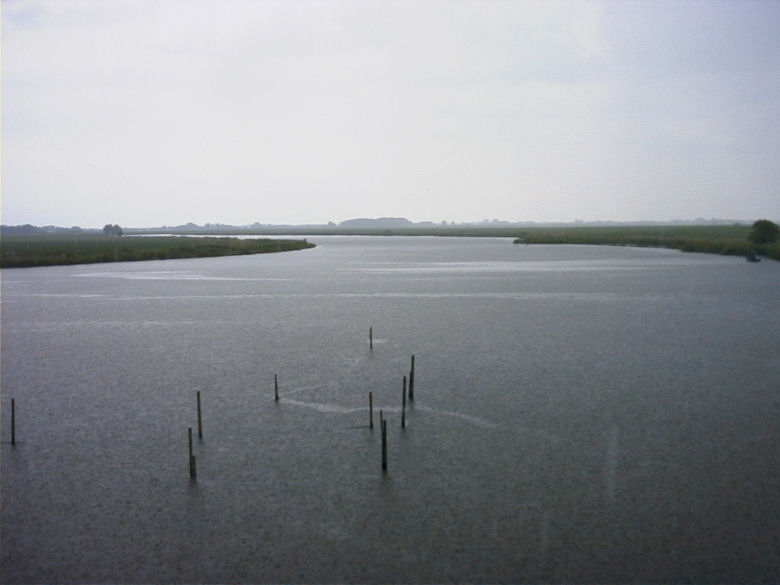 |
| Photo: River Reitdiep |
3.2 Early Modern Times
The sea defences on the western side of the former Lauwerszee, which
protect the Oostergo area from flooding, date from the 11th century. To the
south of the former Lauwerszee the dykes largely date from the 13th century
and were mainly constructed by the Gerkes Monastery. A sea dike was
constructed from Noordhorn to Grijpskerk in the province of Groningen and
from there to Stroobos, and across the western levee of the Lauwers to Burum,
Kollum and Wijgeest. Later a series of new dykes were constructed further to
the north.
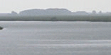
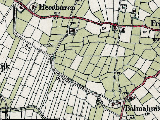 |
| The Oude dyke |
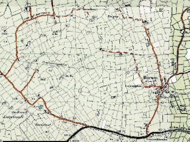
The land
consolidation in the area ranges from irregular, block-shaped plots in the
vicinity of Kollum and Burum, to regularly shaped rectangles in the most
recent polders. Burum is the oldest part of the Lauwers region to have been
brought under cultivation, the numerous winding ditches which form part of
this landscape are the remnants of old creeks. The Lauwers region contains
various kinds of villages.
 |
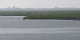
 |
| Block shaped plots near Burum |
Rectangle shaped plots in recent
polder (Kollumerland) |
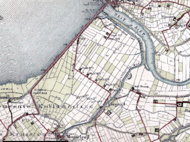
Burum and
Gerkesklooster are earth mound villages, Kollumerpomp and Warfstermolen are
dyke villages and then there are a number of villages that grew up near
locks. Zoutkamp is a former fishing village which became a fortress during
the Tachtigjarige Oorlog. The village was cut off from the sea when the
Lauwermeer dike, a barrier dam, was constructed in 1969.
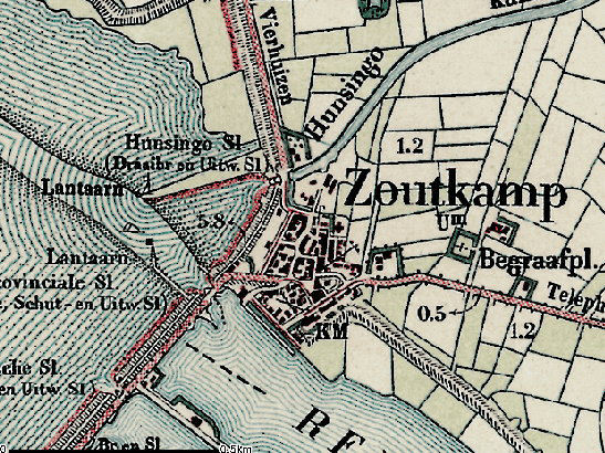 |
| Old map of Zoutkamp |
Other fishing villages include Oostmahorn and Lauwersoog, the latter has a
new fishery harbour with a fish market.
Many rivers used to flow into the Lauwerszee: the Reitdiep at Zoutkamp, the
Lauwers at Munnkezijl, the Dokkumer Ee at Dokkumer Nieuwe Zijlen and the
Zuider Ee at Zumazijl.
Around 1580 a Spanish ruler (stadhouder) had a waterway excavated between
Leeuwarden and Groningen, known as the Kolonelsdiep, which was expanded in
the 20th century to form the Prinses Margriet Canal. In the mid-17th century
the Strobosser boat canal was excavated between the Dokkumerdiep at Dokkum
and the Kolonelsdiep at Stroobos. The Dokkumerdiep was traditionally an
important inland navigation route. Nowadays, after straightening work and
the construction of locks, it is known as the Dokkumer Grootdiep. Like the
Lauwersmeer with its gullies, former salt marshes and flats, the Stroobosser
boat canal and the Prinses Margriet Canal are important and prominent
cultural-historical features that illustrate the origins of the area. After
the Reitdiep was dammed in 1877, locks were constructed at Zoutkamp and in
1920 at Lammerburen, the latter in combination with a pumping station (the
Waterwolf). The Lauwerszee barrier dam also contains an extensive lock
complex. The Lauwerszee therefore contains numerous important hydrological
engineering structures. The sea dykes, secondary dykes and lock complexes
are important and prominent cultural-historical features.
3.3 Modern Times
The former Lauwersmeer estuary was sealed off from the Wadden Sea by
a dam in 1969. It is kept at a constant level of one metre below Amsterdam
Ordnance Datum. As a consequence the former salt marshes and sand-flats have
dried up. The main gullies are however still navigable water. Part of this
area is used for agriculture, part for military training exercises and the
remainder for woodlands and nature conservation areas. A harbour was
constructed near the locks, and this is also the site of the most recent
village in the Netherlands: Lauwersoog. Clay continues to be extracted along
the Dokkumer Grootdiep for brickmaking, where there is also a surviving
brick factory.
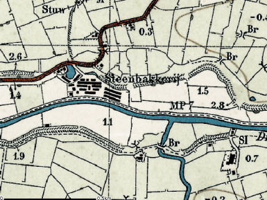 |
| Map of a Steenbakkerij (brick
factory) |
4. Modern development and planning
4.1 Land use
Agriculture is an import sector in the local economy. In this area farming
is still profitable but there is a continuing need for re-strucuturing and
enlargement. This process can threaten the typical patterns of land use and
the farm yards and buildings. Parts of the area are managed by nature
organizations.
4.2 Settlement development
The settlements are small in the region and there is a tendency for the
young people to move away and the houses to be bought by elderly people.
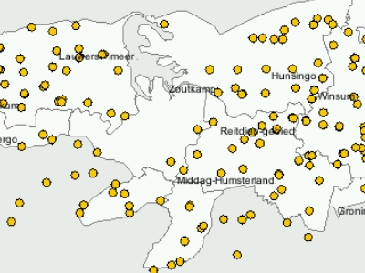 |
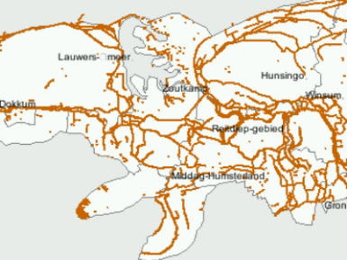
| Villages and settlements in Lauwers |
This has an impact on the viability of the villages. The sub region is an
area with a small economic base. Tourism is concentrated around the
Lauwerslake, at several locations there is overnight accommodation (bungalows
and even complete new-build semi-historical style houses) and facilities
like yachting-marinas and restaurants. In the surrounding area the
appreciation of the area is rising, but there is only a very small tourist
economy.
4.3 Industry and energy
The wide open space of the Lauwers area is conducive to industries like
telecommunication towers and windfarms. There are already wind turbines
beside some farmhouses in Lauwersoog; in Groningen wind turbines are
restricted to harbour areas. Near Grijpskerk and Anjum gas extraction sites
are located, where gas is extracted from beneath the Wadden Sea. Business is
mainly local oriented and is concentrated near the villages, with the
exception of the shrimp industry in Zoutkamp.
4.4 Infrastructure
The dykes are used for transport. There are mainly only local roads, with a
single major road on the barrier dam.
5. Legal and spatial planning aspects
The centre of the entity, the Lauwerslake, is a national park, with a
separate management plan. The Lauwers straddles two provinces, Fryslân and
Groningen.
The regional spatial plan for the province of Fryslân, called the Streekplan,
is an important document for integrated management of landscape and heritage.
This plan provides objectives for regional and local policy, as well as
covering issues of landscape and heritage. The Fryslân Streekplan is
currently being updated. The essential qualities of the different landscapes
of Fryslân are described and those qualities which are seen as important and
should be taken into account in all kinds of decisions are identified. This
recognition of the essential qualities in the landscapes, is an objective of
the spatial plan. The plan (Streekplan) emphasise the need for protection
and protection by development. A document called Nota Erfgoed (Heritage
Plan) covers the responsibilities for the different aspects of cultural
heritage.
The regional spatial plan for the province of Groningen, called Provinciaal
Omgevingsplan II, is an important document in the integrated management of
landscape and heritage. This identifies objectives for regional and local
policy, as well as covering issues of landscape and heritage. Part of this
regional plan for the province of Groningen is called ‘Karakteristiek
Groningen’. In this section the main goals for integrated landscape and
heritage policy are formulated. The actual (historical) landscapes are
so-called ‘starting points’ for new developments and the diversity of
landscapes should be recognizable. These main goals are translated in other
plans, dealing with specific parts of the province.
For the sub regions ‘regioperspectieven’ (a long term perspective for a
region) have been developed.
6. Vulnerabilities
6.1 Settlement
The range of settlement types are vulnerable to change or expansion. The
increase in tourism brings pressure for new development within the historic
cores or on the edge of existing settlements.
6.2 Agriculture
Agriculture is still a profitable industry but there is continuing pressure
to increase production. This process can threaten the historic patterns of
land use and the farm yards and buildings.
6.3 Tourism
There is only a very small tourist economy but this is beginning to expand.
In and directly around the National Park Lauwersmeer, the recreation
facilities for tourism are expanding rapidly. On the borders of the area
developments in tourism and recreation, mainly on a small scale, are
occurring. For example, alongside the village of Oostmahorn a large holiday
home park with new historical style houses and layout has developed, called
Esonstad. If the cultural heritage of the area is not integrated into these
initiatives negative impacts on the landscape and heritage can take place.
6.4 Industry and energy
Gas extraction, wind turbines and large buildings can have an adverse effect
on both the visual amenity of the historic landscape and the buried cultural
heritage. The qualities of parts of this landscape are its openness, its
quietness and its darkness and these are at threat from continuing
industrial growth.
7. Potentials
7.1 Settlement
The range of historic settlements, including earth mound villages, dyke
villages, lock villages and fishing villages provide an important range of
settlements which have the potential to promote the diverse occupation
history of the Lauwers entity.
7.2 Agriculture
The cultural history of the settlements and landscapes of this area are
identified in different initiatives, regional and local, and the potential
for both promotion and management of the area should be exploited.
7.3 Tourism
The visible history of water management through the ages is an important
strength of the landscape. The Lauwers is still feeding the (former) sea bay
Lauwers sea. The Lauwers is the border river between the provinces of
Groningen and Fryslân. The lake is still a significant element in the
water-management of both provinces. The many dikes, and the natural and
manmade waterways demonstrate the history of habitation and cultivation of
this area. The historical development of embanking and reclamation of the
sea estuary throughout the centuries is still visible. As with the contrast
between the natural landscape in the former sea area and the historical
developments on the banks, these provide an important part of the history of
the area and could be promoted via tourism. The story of the monastery of
Gerkes Klooster is an important example and could be used as a focal point
interpreting the story of this area.
7.4 Nature conservation
There are opportunities to improve the relationship between Lauwers and its
former sea estuary by promoting the historic landscape and cultural history
of the area in an integrated manner with nature conservation and tourism.
7.5 Industry and energy
Development of traditional industries such as fisheries, brick and pottery
manufacturing, provides opportunities to strengthen the economy and
encourage local tourism.
8. Sources
Marrewijk, D & A.J. Haartsen, 2002, Waddenland Het
landschap en cultureel erfgoed in de Waddenzeeregio, Ministerie van Landbouw,
Natuurbeheer en Visserij / Noordboek, Leeuwarden
Provincie Fryslan, 2006, Streekplan. Leeuwarden
Provincie Groningen, 2000, Provinciaal Omgevingsplan, Koersen op Karakter,
Groningen
|