|
1. Overview
|
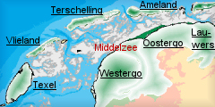
Name: |
Middelzee |
|
Delimitation: |
The east dyke of Westergo and the west dyke of Oostergo, in the north by the
coastline |
|
Size: |
around
170 km² |
|
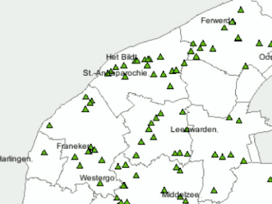
Location
- map: |
Province of Fryslân |
|
Origin of name: |
The name
'Middelzee' only came into use around 1500. Before that the names Boorne, Bordine or Bordena, meaning border, were used as far back as the 8th century for the Middelzee. |
|
Relationship/similarities with other cultural entities: |
As a marine bay, the area has similarities to the Lauwers and the
Dollard |
|
Characteristic elements and
ensembles: |
The former Middelzee bay
is still recognisable in the landscape due to the old seawalls of
Westergo and Oostergo. The area is an open landscape with cross dikes
which indicate the phases of silting up. Rectangular large-scaled
structured landscape; Oude en Nieuwe Bildtdijk with typical housing on
the old sea wall; 't Bildt' farm buildings, sluice villages |

2. Geology and geography
2.1 General
The landscape of the Middelzee and the Marne originally consisted of a
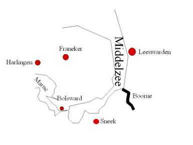
number of bays. Around 500 BC the Middelzee was an estuarine bay of the
river Boorne separating Oostergo from Westergo. Over time this inlet found
its way deeper and deeper inland. A western branch originated c.1000 AD in
the neighbourhood of Bolsward, on the Marne. The northern part of Westergo
was at that time entirely surrounded by water, or at least by salt marshes
which were submerged at high tide.
 |
 |
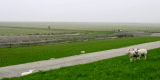
| Middelzee and river Boorne |
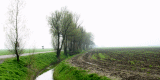
Dykes in Middelzee |
2.2 Present landscape
The landscape is open and predominantly agricultural. The various cross
dikes are visible in the landscape, as are the former sea dikes, which now
have an important role in carrying traffic.
3. Landscape and settlement history
3.1 Prehistoric and Medieval Times
The first dikes in Oostergo and Westergo were built in the 11th century. At
the same time the Middelzee and the Marne bay began to silt up. Bit by bit
the old sea inlets were surrounded by dikes and transformed into
agricultural land. Reclamation began once an area had become sufficiently
silted up, and the dike would form a dam across the land. For reclamation in
this area, the dikes of the old land formed the basis for new barrages. Land
was reclaimed in one of two ways. The residents created local embankments
that ran parallel to the Middelzee dikes. The Piksharnedijk to the west of
Goutum is such an embankment. More important, however, were the dikes laid
across the Middelzee dikes, which dammed up parts of the channel. With the
construction of each new dike to seaward, the previous dike lost its
function as a sea dike and became a sleeper or inner dike - a second line of
defence.
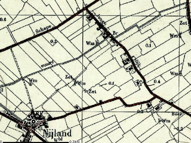
The creation of the polders began to the east of Bolsward. The first
enclosure of part of the Middelzee was the Skieppeleane/Jonge Dijk to the
north-east of the village of Nijland. This dike was built at the beginning
of the 11th century, enabling the cultivation of the Marlan.
 |
 |
| Sleeper or inner dykes |
Skieppeleane/Jonge Dijk north-east
of the village of Nijland |
The exact
position of the seaward Middelzee dike to the south of the Marlan is
uncertain. The reclamation of this area made the low-lying peat moors to the
south of the Marlan safe from flooding. Shortly after that the
Hartwert-Kliuw dike was built, closing off the Middelzee inlet in the
direction of Waaxens. The next barrier, at the start of the 12th century,
was the Nijlandsdijk/Lage Dijk between Grootewierum and Scharnegoutum.
Around 1240 the Krinserarm was embanked on a level with Easterwierrum and
Raerd. This short dike closed off the south-western arm of the Middelzee. In
the 13th century the process of silting up accelerated as the Zuiderzee was
formed. Around 35 years later the Boksumerdyk was built eight kilometres
north of the Krinserarm, claiming approximately 2500 hectares of new land
from the sea. The Skr‚dyk, from Beetgumermolen to Stiens followed around
1300. This was the last dike in the reclamation of the Middelzee. The
reclaimed lands were used largely as pasture.
 |
| Photo:
The Skrédyk |
The new lands
of the Middelzee have never been heavily populated as most of the land was
divided between the existing settlements sited on the old land. The
settlement pattern in these areas still largely consists of dispersed
buildings. With the exception of the village of Nijland, the farms tend to
be located along the old dikes. Part of the new land was reclaimed by the
monasteries sited on the edges of the Middelzee, such as those at Thabor and
Nije.
 |
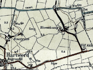 |
| Dwelling mounds (terpen) in
Middelzee |
Map of monastery Bloemkamp |
The amount of
new land available to them was limited, because the surrounding villages
were keen to use the new land themselves. However, the monasteries obtained
their estates through dike breaches and floods; if an owner could not afford
to restore a dike after a breach, the monasteries took over the land. The
Krinserarm dike was built entirely by a monastery. The Bloemkamp monastery
was founded around 1190 on reclaimed land.
3.2 Early Modern Times
The area continued to silt up, allowing more polders to be created.
These new lands however no longer belonged to Oostergo or Westergo: instead
a new community was formed: the Bildt. This area was reclaimed under the
regime of the Duke of Saxony. Around 1500 he appropriated the lands outside
the dikes and concluded an agreement with four Dutch nobles to enclose the
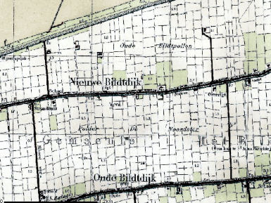
area with dikes and prepare it for use. The first dike in the Bildt was the
Oude Bildtdijk, which enclosed the old Bildt. In 1600 the Nieuwe Bildtdijk
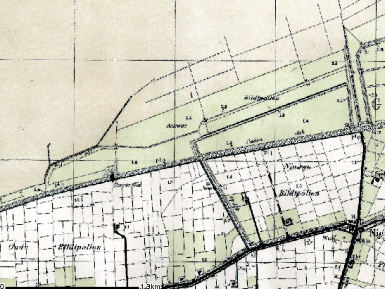
and the Koedijk were built and the Nieuw Bildt polder was formed. These two
dikes became sleeper dikes when the Poldijk and Noorderleegdijk were built
in 1715 and 1754, to enclose the Oude Bildtpollen and the Nieuwe
Bildtpollen. According to Frisian tradition, several inner dikes were also
built to provide protection if the seaward dike was breached. The new lands
of the Bildt proved ideal for arable farming, particularly for seed potatoes.
 |
| Photo: New land of the Bildt |
A number of
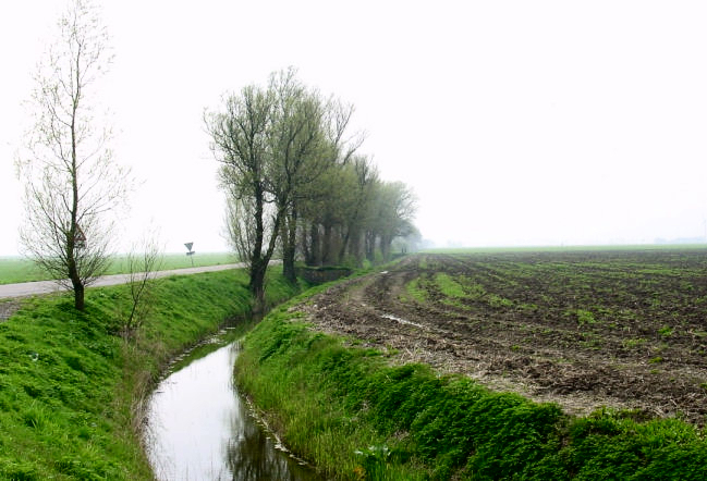
waterways were dug for the drainage of the Marne bay and the Middelzee. In
the southern polders these waterways often have an irregular course, while a
network of straight waterways was created in the Bildt. In places where
small drainage channels crossed a sea dike, a sluice or zijl was created to
discharge the water. As more and more dikes were built this type of sluice
was found increasingly in the middle of the countryside, by a former sea
dike where the channel once emptied into the sea. For example, at Oude Leije
there was an important Oostergo sluice, which discharged polder water into
the Middelzee. After the reclamation of the Bildt the sluice had to be moved
further seawards in the Oude Bildtdijk/Koedijk, and the village of Bildtzijl
grew up around it. However, as the Bildt continued to silt up, the sluice
quickly fell out of use, and in the next reclamation phase a new sluice was
built in an extension to the old drainage ditch. In the end there were three
sluices in a row, each with its associated village: Oude Leije, Oude
Bildtzijl and Nieuwe Bildtzijl. The sluice at Nieuwe Bildtzijl is still used
to discharge excess polder water.
 |
| Photo: Oude Bildtzijl sluice |
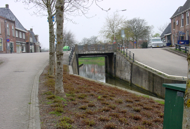
Both Oostergo and Westergo had been in the habit of discharging water into
the Middelzee, but drainage became a problem as the water turned into land.
The Zwette was dug to form a boundary between Oostergo and Westergo.
Westergo could still discharge water here: however as the dike was on the
Oostergo side, the discharge point for Oostergo had to be moved to the
Wadden Sea. In the 17th century the Zwette was widened to become a boat
canal.
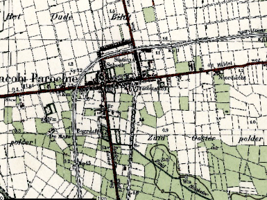
In contrast to the southern lands of the Middelzee, there are new
settlements in the Bildt. As well as the ribbon developments along the roads
several new villages have developed. The villages in this area take various
forms. Sometimes a sluice would attract economic activity and typical sluice
villages like Oude Bildtzijl grew up around them. In the Oud Bildt there are
linear settlements sited along the central road, the Middelweg, or at
crossroads. Three settlements were established from west to east along this
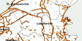
road: Wijngaarden, Altoena and Kijfhoek. Wijngaarden and Kijfhoek are named
after the South Holland homes of the nobles who ran the reclamation works in
the Bildt. The place names changed over time to the names of the parishes,
giving us the present-day Sint Jacobiparochie, Sint Annaparochie and Lieve
Vrouwenparochie.
 |
 |
| Linear settlements in the Oud Bildt |
Historical farm buildings in
Middelzee |
3.3 Modern Times
The former Middelzee which includes the Bildt, is a primarily agricultural
area and has been traditionally used, managed and maintained on agricultural
lines. It has been undeveloped for a long time and therefore still open.
However, there has been a military airfield in the north of the Middelzee
for some decades.
4. Modern development and planning
4.1 Land use
The south of the area is largely used for livestock farming and the north
for arable cultivation with a specialisation in seed potatoes. Agriculture
is a vital sector in the area, still capable of growth and innovation.
4.2 Settlement development
In the south, except in the village of Nijland, the dwellings are
dispersed as a consequence of land division. The land newly reclaimed from
the sea was added to existing villages. Leeuwarden has recently expanded
further west to reach into the Middelzee area. Further expansion is
anticipated.
The Bildt is the only place where new settlements have been built, and these
are small, planned, new-build projects.
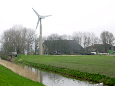 |
4.3 Industry and energy
In such an agricultural area, industry and energy sources tend to be
agriculturally related. Wind turbines are set up at farms. There are
business parks close to Leeuwarden, within the cultural entity of
the Middelzee.
4.4 Infrastructure
The dikes now serve as roads. This makes them stand out in the
landscape. A new provincial road is planned towards the Bildt. There
is an active military airfield to the west of Leeuwarden, used by
fighter jets, which causes noise nuisance. |
|
Photo:
Wind mill near a farm |
|
5. Legal and spatial planning aspects
The Legal and Spatial Planning Aspects are described in a general way, as
these are relevant to all the cultural entities in the province of Fryslƒn.
Due to the scale of the cultural entities (which cover more then one
municipality), the focus is on regional policy and management. However, the
goals of the regional policy and planning strategy are taken into account by
the local sector planning policy. The regional goals and strategies are
formulated after discussion with a wide range of stakeholders and
organisations.
The regional spatial plan for the province of Fryslƒn, called Streekplan, is
an important document in terms of the integrated management of landscape and
heritage. This plan presents objectives for regional and local policy, as
well as considering issues of landscape and heritage. At this moment (mid
2006) the province of Fryslƒn is finalising her new regional spatial plan.
The essential qualities of the different landscapes of Fryslƒn are described.
These qualities are seen as important and should be taken into account when
making planning decisions. The recognition of the essential qualities of the
landscapes, and the strengthening of them, is a primary objective. The plan
(Streekplan) emphasises the need for protection of the historic landscape
and protection by development.
Chapters are devoted to landscape and to heritage. Both stress the
importance of careful planning. Municipal councils are specifically asked to
take landscape and heritage values into account. Extra emphasis is placed on
zones beside major roads and the incorporation of large infrastructural
works and radio masts. The plan also emphasises that there must be scope for
new developments, such as horticulture zones, new business sites, larger
residential areas, station areas, rural estates in urban expansion areas,
certain large quality arrangements, new nature areas and large recreation
parks. By imposing high quality standards on these developments, we create
new landscape and heritage qualities for the future. Creating and
maintaining new landscapes is primarily a development task for local
councils.
6. Vulnerabilities
6.1 Spatial Planning
The planned landscape of the Middelzee area is vulnerable to random spatial
developments in housing, industry and intensive agriculture.
6.2 Settlement
The structure of the historic villages and their skyline are easily damaged
by inappropriate development. On the Oude - en de Nieuwe Bildtdijk - the
maintenance of the typical housing in the slope of the sea wall and the
method of construction of new houses are issues of concern.
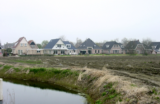 |
| Photo: New houses in Beetgum |
6.3
Agriculture
Large concentrations of greenhouses can have a substantial negative impact
upon the histroic landscape and buried archaeology. The maintenance of the
open character of the Middelzee area is vulnerable, especially along the
borders with Westergo and Oostergo into the south (Leeuwarden West already
forms a visual barrier).
6.4 Industry and energy
Wind farms in the western part of Leeuwarden endanger the open landscape.
7. Potentials
7.1 Strategic Planning
Careful strategic planning has the potential to design large scale
developments within the existing landscape respecting the historic layout.
7.2 Settlement
A range of settlement types from dispersed farmsteads to sluice villages
have developed within the area. These have potential both for their historic
development and their tourism potential.
7.3 Agriculture
A strong agricultural sector has the potential to conserve the vastness and
structure of the landscape. The two Bildtdijken should keep their exclusive
appearance and spatial surroundings being an unique feature in the whole
Wadden Sea area.
7.4 Tourism
Developing of landscape and cultural tourism has real potentials as this
area is so different compared with the other areas along the coast. In
particular the re-use of historic buildings like houses and farm buildings
should be enhanced. The area?s specific history of land consolidation may be
used in the broader perspective of cultural tourism along the Wadden Sea
coast.
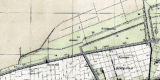
 |
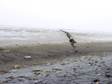 |
| Land consolidation in Middelzee |
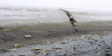
Photo: Mud flats of Northern
Friesland |
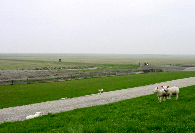
7.5 Nature
conservation
In the north, just behind the dike, are the mud flats of northern Friesland,
an area of high nature value visited by waterbirds. The integration of
nature conservation and heritage conservation provides significant potential
for both the protection, management and promotion of the cultural heritage.
8. Sources
Marrewijk, D & A.J. Haartsen, 2002, Waddenland Het
landschap en cultureel erfgoed in de Waddenzeeregio, Ministerie van Landbouw,
Natuurbeheer en Visserij / Noordboek, Leeuwarden
Provincie Fryslan, 2006, Streekplan. Leeuwarden
|