|
1. Overview
|
Name: |
Schiermonnikoog |
|
Delimitation: |
Island in the Wadden Sea. |
|
Size: |
39
km² |
|
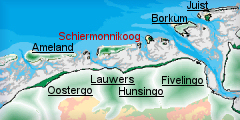
Location
- map: |
Province of Fryslân |
|
Origin of name: |
Island of the Grey Monks
– the Cistercians |
|
Relationship/similarities with other cultural entities: |
Relationship with Ameland and Borkum (Germany), neighbour
islands |
|
Characteristic elements and
ensembles: |
The island consist mainly
of dunes with one village on the west side, duck decoy, lighthouses. |

2. Geology and geography
2.1 General
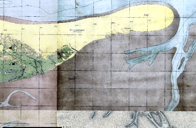
Schiermonnikoog is one of the Friesian Wadden Sea islands off the northern
coast of the Netherlands that separate the Wadden Sea and the North Sea. The
landscape developed after the last ice age, rising sea levels, coupled with
a higher fresh groundwater level, led to the development of a zone parallel
to the coast in which peat was able to develop on a large scale. Clay and
sand were deposited on this peat layer facing the sea, whilst the peat on
the landward side spread out over the more elevated sandy areas. As a
consequence of the flooding of the Straits of Dover, the sea current changed
direction and began to run more in parallel with the coast. This gave rise
to a series of low-lying dune ridges, broken by rivers flowing into the sea.
As a result of later marine incursions, the peat behind the ridges was
eroded and the ridges were divided up into smaller pieces: the Wadden Sea
Islands.
Schiermonnikoog bears all the evidence for having developed in a dynamic
coastal area, with erosion in some areas and deposition in others due to the
strong sea current having a major influence on the form the island has taken.
Like Terschelling and Ameland, Schiermonnikoog is an elongated island that
becomes narrower at the eastern end, with a village sheltering in the dunes.
 |
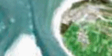
 |
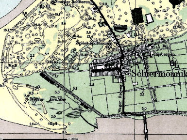
| The village of Schiermonnikoog |
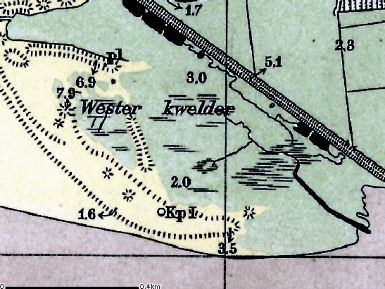
Salt marsh (Wester kwelder) |
In addition the
island has an area of reclaimed saltmarsh, hook-shaped sandbars on the
western side and extensive dunes and saltmarsh flats on the eastern side.
Due to the processes of accretion and erosion the island is continually
subject to erosion on the western side, with a distinct tendency for the
island to shift eastwards.
 |
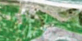
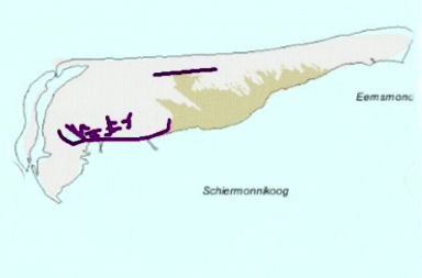 |
| Eastern part of Schiermonnikoog |
Dykes on Schiermonnikoog |
The coastal protection scheme allows these natural processes to take place
only on the west and east sides of the island.
2.2 Present landscape
Schiermonnikoog is the smallest of the inhabited Wadden Sea islands and has
undergone numerous changes due to the continuing erosion on the western side.
Like the other Wadden Sea Islands it comprises sand with a few salt marshes.
3. Landscape and settlement history
3.1 Prehistoric and Medieval Times
The name of the island – “Island of the Grey Monks” - comes from the
original owners, the Cistercian monastery of Klaarkamp. “Schiere” stands for
the grey habit worn by the monks. The monks were the first settlers of
Schiermonnikoog, they cultivated the ground for agriculture and worked on
the land. In 1638 the monastery fell into private hands.
3.2 Early Modern Times
Agricultural activity on Schiermonnikoog is limited and consists
mainly of livestock farming, with the cultivation of vegetables and cereals,
both for human and animal consumption. The farms are sited on the edge of
the salt marsh and the village. Apart from agriculture, fishing and whaling
were an important source of income for the islanders. Whale jawbones in the
village, forming a portal over a footpath, provide a reminder of the
islanders’ former involvement in the whaling industry. As on many other
Wadden Sea islands, there is also a duck decoy on Schiermonnikoog,
consisting of a lake, the cage-pond and one or more tunnels. The area is
surrounded by a wood or swamp forest where ducks can rest on the water and
take refuge from the wind.
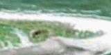
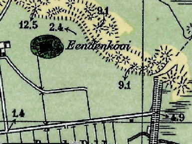 |
| Duck decoy (Eendenkooi) on
Schiermonnikoog |
The history of Schiermonnikoog is that of a continuous battle against the
sea. In 1717 the church in the former village of Westerburen had to be
relocated. The move proved, however, to be short-lived, for in 1760 the
church came under renewed marine threat. In 1762 a third church was built
and the area around this was laid out in the regular plots that remain
characteristic of the village to the present day. Westerburen is the only
planned village on the Wadden Sea islands. The island also has an old
lighthouse, known as the Water Tower, and a new lighthouse was built in
1854. As a result of the natural shifting of the island, the old lighthouse
became too widely separated from the sea and a new one had to be built. The
old lighthouse was subsequently used as a water tower and now also serves as
a radio mast.
3.3 Modern Times
At the end of the 19th century a forest was planted on the island,
both for timber production and in order to prevent the dunes from eroding.
Schiermonnikoog also has a cemetery, the Vredehof, established in 1917 as a
burial place for drowned sailors washed up in the First World War. Another
element of the Schiermonnikoog landscape is the Wasserman Bunker,
constructed during the Second World War. At the start of the Second World
War the island was owned by the German Count Von Bernstorff; after the war
it was confiscated. Since then it has been administered by the State
Property Department, which transferred the dunes and the non-empoldered
salt-marshes to the Society for the Preservation of Nature in the
Netherlands.
An important development was the advent of tourism in the 19th century, with
Schiermonnikoog being one of the first Dutch Wadden Sea islands where this
took place. The German Wadden Sea islands were already developed for tourism
in the 18th century. The accessibility of the Dutch Wadden Sea islands has
been an important factor in the development of beach tourism. In the
mid-19th century it took four and half hours to reach Schiermonnikoog by
boat, preceeded by a stagecoach journey from Groningen. The earliest
facilities were designed mainly for rich guests and largely consisted of a
spa. The pure sea air was particularly commended. The first seaside hotel
was built on Schiermonnikoog in 1887. Despite its excellent location, with
which it made its name amongst its mainly German guests, the hotel did not
last long: in 1925 it disappeared beneath the waves. By then the first
guesthouses had appeared. One of the first guesthouse operators on the
island was a former policeman, Sake van der Werf. His guesthouse turned out
to be so profitable that he was able to build a substantial hotel in the
middle of the village, later followed by a hotel on the sea. The hotels and
guesthouses were followed by holiday houses, villas, campsites and bungalow
parks. Particularly since the 1960s, there has been an exponential growth in
long-stay recreation on all the Wadden Sea islands.
Like the other Wadden Sea islands, Schiermonnikoog remains locked in a
continual struggle with the sea. The centuries-old battle against accretion
and especially the erosion of land, whereby the island appears to be “walking”,
continues unabated.
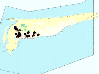 |
| Places of recommendation on Schiermonnikoog |
4. Modern development and planning
4.1 Land use
With regard to agricultural activity on the island, there is virtually no
scope to increase the area under production. Schiermonnikoog has clearly
indicated that its priorities lie with nature, the landscape and cultural
history.
4.2 Settlement development
With regard to housing the assumption is that at least 40 homes will need to
be added by the end of 2010 for people having social and economic ties to
Schiermonnikoog. A high proportion of the employment on Schiermonnikoog is
directly or indirectly related to leisure. Building these houses will
require an extension of the village into the open landscape of either the
polder or the dunes.
4.3 Industry and energy
There is one small business park, Melle Grietjespad, which contains a number
of small companies, most of them related to tourism.
4.4 Infrastructure
The number of paved roads for cars is very limited and visitors are
restricted from bringing their cars to the island. The island, like Vlieland,
is very quiet in terms of traffic. There is a network of cycle and walking
paths. In terms of traffic, the Structure Plan of Schiermonnikoog allows for
the extension of the recreational path on the eastern side of the Westerplas.
5. Legal and spatial planning aspects
Schiermonnikoog is a National Park but the village is not part of the formal
park area. The formal management plan of the National Park was developed
with the inhabitants of the island and it of course influences many aspects
of life on the island.
The general Legal and Spatial Planning Aspects are described in a general
way, as they are relevant for all the cultural entities in the province of
Fryslân. Because of the scale of the entities (most cover more then one
municipality), the focus is on regional policy and management. Besides that,
goals of regional policy and planning are taken into account by local and
sector policy. The regional goals and strategies are always formulated after
consultation with sectors, stakeholders and organisations.
The regional spatial plan for the province of Fryslân, called Streekplan, is
an important document in terms of the integrated management of landscape and
heritage. This plan comes up with the objectives for regional and local
policy, also on issues of landscape and heritage. At this moment (mid 2006)
the province of Fryslân is finalising her new regional spatial plan. The
essential qualities of the different landscapes of Fryslân are described.
These qualities are seen as important and are taken into account in all
kinds of decisions. Recognition of the essential qualities in the landscapes,
or strengthening them is a main objective. The plan (Streekplan) emphasise
the need for protection and protection by development.
In provincial (spatial) policy, the Frisian islands have a special position
because of their very specific situation. The landscapes, the nature and the
cultural heritage is highly valued, and the space for development is limited.
The general policy on development is to look for opportunities for improving
the quality of the existing supply, instead of a further extending it.
6. Vulnerabilities
6.1 Settlement
The expansion of tourism is resulting in added pressure to expand the
settlement pattern on the island with the possibility of altering its
historic character. The re-use of the buildings on the farmyards doesn’t
always fit in to the historic character of the island.
6.2 Agriculture
Agriculture remains an important part of the economy of Schiermonnikoog,
although there is the potential for decline in this sector. The scale of the
farms is small and as a result they need to look for alternative
supplementary incomes, frequently via tourism. The challenge remains to look
for new means to keep sustainable agriculture on the islands.
6.3 Tourism
The development of tourism over the last decades has resulted in changes to
the village on the island. The island houses a campground, a ferry pier, a
tidal harbour for small vessels and approximately 15 hotels and hundreds of
vacation houses and apartments. The nature of the accommodation is also
becoming redundant as new forms of tourist accommodation are wanted. Lack of
investments in the quality of the tourist infrastructure by entrepreneurs
can lead to a decline of the tourist economy.
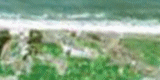
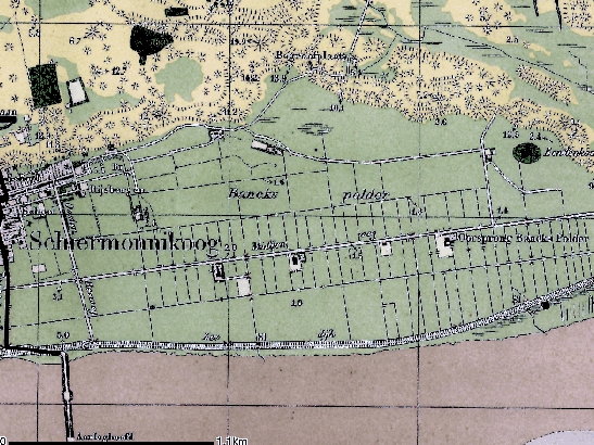 |
| Main polder on Schiermonnikoog |
6.4 Nature conservation
Nature protection is important on the island and measures for nature
protection can sometimes be been in conflict with the existing landscape
values.
6.5 Natural processes
A continual process of erosion is taking place which threatens cultural
heritage assets on the island.
7. Potentials
7.1 Settlement
The village on Schiermonnikoog was planned with small streets and small
houses, which is well preserved. Its character should be preserved and
promoted.
7.2 Agriculture
The growing awareness of the importance of the local agricultural economy
for the landscape and heritage should be encouraged with the potential of
promoting local produce and retaining historic farming methods.
7.3 Tourism
The policy for sustainable tourism for the Wadden Sea islands supports some
growth in tourism on Schiermonnikoog. The tourists are seeking higher
quality and diversity in the accommodation and activities on offer and this
provides great potential for the management, promotion and preservation of
the cultural heritage of the island. The good accessibility of many parts of
the island both by foot or cycle provide the potential for the creation of
cultural heritage routes or integrated cultural heritage and natural
environment trails.
7.4 Nature conservation
Nature protection is important on the island and provides the potential to
create integrated management plans for the protection and promotion of both
the natural environment and cultural heritage.
8. Sources
Marrewijk, D & A.J. Haartsen, 2002, Waddenland Het
landschap en cultureel erfgoed in de Waddenzeeregio, Ministerie van Landbouw,
Natuurbeheer en Visserij / Noordboek, Leeuwarden
Provincie Fryslan, 2006, Streekplan. Leeuwarden
Provincie Groningen, 2000, Provinciaal Omgevingsplan, Koersen op Karakter,
Groningen
|