|
1. Overview
|
Name: |
Texel |
|
Delimitation: |
Island, neighbouring entities Vlieland, Kop van Noord-Holland. |
|
Size: |
160
km² |
|
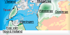
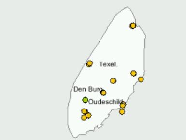
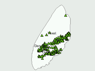
Location
- map: |
Province of Noord-Holland |
|
Origin of name: |
First annotation as Insula Texla in the Middle Ages. |
|
Relationship/similarities with other cultural entities: |
Connected with Wieringen, both islands have a core of glacial
till. |
|
Characteristic elements and
ensembles: |
Glacial till relief,
sheep sheds, turf-banks. |

2. Geology and geography
2.1 General
Texel differs from the other Wadden Sea islands in that the core of the
island consists of glacial till, deposited during the penultimate glaciation
when large parts of the Netherlands were covered by ice. After the last ice
age, about 10,000 years ago, the surrounding areas underwent considerable
physical changes, but the glacial till deposit remained firmly in place and
has shaped much of the coastline of the northern Netherlands. The island
subsequently grew in size through the accretion of sand around the till
deposit and the formation of sand flats.
2.2 Present landscape
The natural dynamics of the sea environment around Texel continue
undiminished. The Noorderhaaks sand flat is currently moving in an easterly
direction and will probably eventually connect with Texel. The island is
growing. The present landscape on the island of Texel is one of dunes,
pastureland, woods and polders.
3. Landscape and settlement history
3.1 Prehistoric and Medieval Times
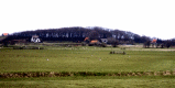
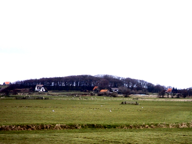
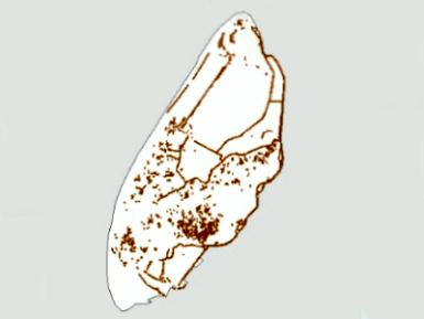
The highest point of Texel outside the dunes area is the Hooge Berg
near Den Burg (15 m), the centre of the glacial till deposit. The Hooge Berg
has always attracted human interest, partly because of its proximity to the
sea, and scattered archaeological finds are evidence of human activity in
the Palaeolithic and Mesolithic periods. The site may have been permanently
occupied since the Middle Bronze Age, and for a long period the main form of
subsistence was agriculture and fishing. Den Burg is thought to be Viking in
origin, with the central circular ring thought to date to this period. The
outer ring is a bulwark dating from the 14th century.
 |
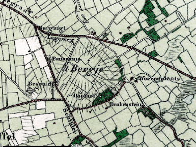 |
| Photo: Texel's highest point: Hooge
Berg |
Map of Hooge Berg |
3.2 Early Modern Times
The appearance of the present-day island of Texel has been shaped
partly by natural processes and partly by human action. The island increased
in size because a sand dike (1629?30) was built between the original island,
which consisted mainly of low hills of glacial till and cover sand, and the
dune island of Eijerland. The salt marsh to the east was surrounded by a
dike and reclaimed in 1835 (the Eijerland Polder).
 |
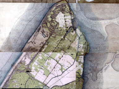 |
| Dykes on Texel |
Eijerland Polder, Texel |
Subsequently,
in 1855, a new sand dike was built further out towards the sea beyond the
first dike, but in 1858 this second dike was breached by the sea in three
places. One of these openings, the Slufter (meaning a tidal creek or sea
inlet), still exists today. To the south-west of the island lie a series of
curved sand banks with dunes and an adjoining sand flat, the Hors. In the
1930s the Hors expanded as the Onrust sand flat, which had formed in front
of the entrance to the Marsdiep channel, moved to the east and came to rest
against Texel. A process of accretion was also set in motion on the eastern
side of the island and an area of salt marsh was formed, which was gradually
raised by the deposition of sediments and eventually became dry land. These
salt meadows make good agricultural land, and in 1847 they were enclosed and
reclaimed to create the Prins Hendrik Polder.
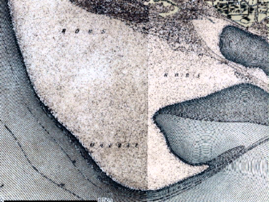 |
 |
| Onrust sand flat at the south of
Texel |
The Prins Hendrik polder |
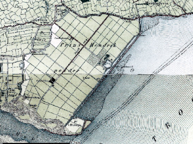
The island's
inhabitants used the landscape for agricultural activities. The old land was
cultivated in small fields, whereas the new polders were divided up into
regular parcels. Besides agriculture, the inhabitants were also active in
fishing and providing supplies and storage for shipping.
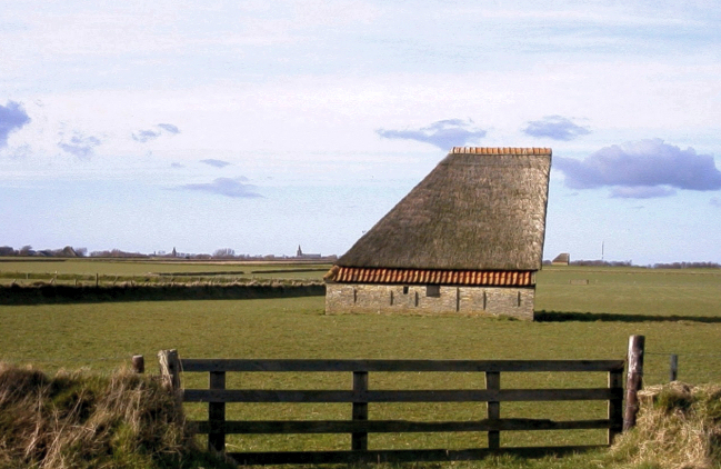 |
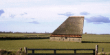
| Photo: Sheep shed (schapeboeten) |
Specific
features of the island are the schapeboeten, or sheep sheds ? which recall
the importance of sheep farming to the area ? and the turf-banks (tuunwallen),
which are walls built from grass turf, usually about a metre high. They date
from the seventeenth or eighteenth century. This method of field division
was only used on the higher ground where the water level was too low for
ditches.
 |
| Photo: Sod-banks (tuunwallen) |
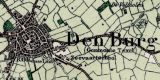
The settlements
on Texel are mostly in the form of linear settlement, such as Den Hoorn. Den
Burg is an exception; it is situated in the centre of the island and
therefore assumed the role of core settlement. Most of the oldest buildings
on Texel are found in Den Burg, such as the 15th century Reformed Church,
the Oudheidkamer (Museum of Antiquities) and several fine 17th century
houses.
 |
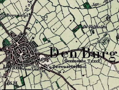 |
| Settlements on Texel |
Map of Den Burg |
Texel also has
a seaport, Oudeschild. For a short time Oudeschild was a naval port, until
this role was taken over by Den Helder. The harbour dates back to 1780, but
long before that merchant ships used to wait in the anchorage off Texel for
favourable winds. The presence of the Marsdiep channel, which allowed large
ships to set sail when the wind was favourable, provided an enormous boost
to the island economy.
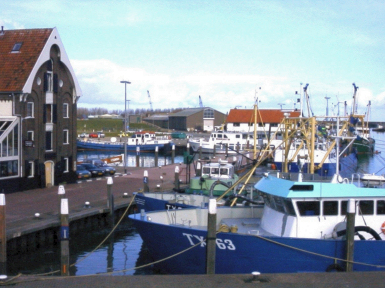 |
| Photo: Texel, harbour Oudeschild |
The wells of Brakenstein farm at the foot of the Hooge Berg provided water
to provision the ships, including those of the East India Company. The
Schilsloot canal was dug early in the 17th century to facilitate transport
of the water barrels, which were carried by rowing boat from the wells to
the ships. The proximity of the Marsdiep channel was also of strategic
military importance and the Oude Schans fortification to the east of
Oudeschild, which dates from the Eighty Years War, has had a long and active
history.
3.3 Modern Times
The landscape that we see now on the island has been transformed by careful
landscape planning, because 100 years ago it was a largely open landscape.
At that time the newly established National Forest Service (Staatsbosbeheer)
was granted 3000 hectares of land on Texel and planted part of this with
trees. The resulting woods now contribute to the variety of the landscape.
4. Modern development and planning
4.1 Land use
On the island of Texel there has been a long tradition of agriculture.
The great variety in the shape of the fields, woods and other plots of land
that emerged over time on Texel has been greatly diminished by the land
consolidation projects carried out in the 20th century.
 |
Historical
farms on Texel |
The process of field enlargement is still ongoing and agriculture is still
the main economic base for the island. The old land, the dunes and the shore
have been restored to a natural state. The Wadden Sea is widely recognised
as a special environment and is likely to be nominated as a World Heritage
area.
4.2 Settlement development
The islands of the Wadden Sea, because of their beauty, are extensively
protected by legislation. A lot of the settlements are protected as
monuments, which means that there are no large-scale building works near the
villages or in adjoining fields. The influence of tourism can be seen in a
village like De Koog where all the houses have been converted to hotels,
second homes etc, leading to widely varying seasonal population and
employment levels.
4.3 Industry and energy
Beside agriculture and tourism there are no other important industries on
Texel. Apart from a few wind turbines near farmsteads there are no
energy-creation sources on the island.
4.4 Infrastructure
There is a single main road on the island from the harbour to De Cocksdorp,
with side roads connecting to this and there are no congestion problems on
the island. The tourism industry is supplied with an excellent pattern of
paths for cycling and walking.
5. Legal and spatial planning aspects
The Legal and Spatial Planning Aspects are described in a general way, as
these are relevant to all the cultural entities in the province of Noord
Holland. Due to the scale of the entities (which cover more then one
municipality), the focus is on regional policy and management. However, the
goals of the regional policy and planning strategy are taken into account by
the local sector planning policy. The regional goals and strategies are
formulated after discussion with a wide range of stakeholders and
organisations.
In October 2004, the Province of Noord-Holland put into force the
Development Perspective of the sub region Noord-Holland-noord in the
framework of the regional spatial planning. The area of the Hooge Berg and
up to the north east is designated as a Landscape Pearl because of its very
special landscape and cultural history.
The landscape and cultural history of the area should be the leading
principle in the management and development of the area. Limited development
of housing and industry is allowed on a local level. Quality tourism is to
be promoted, however there should be no increase in overall numbers.
Agriculture should be continued in a sustainable way. The rest of the
agricultural part of the island is designated as an area for maintenance and
development of agriculture, taking into account the landscape and cultural
history values. The dunes and beach area are protected for nature
conservation.
6. Vulnerabilities
6.1 Settlement
The expansion of tourism over the last few decades has clearly impacted on
the historic settlement pattern of Texel. New build and extensions have had
an impact on the visual impact of the historic settlements, although the
general settlement pattern survives.
6.2 Agriculture
The historic fieldscape has largely disappeared since the 1960?s as a result
of boundary loss, through the process of consolidation and field enlargement
which is still continuing. Many historic landscape features such as turf
banks are threatened by modern agricultural land-use.
6.3 Tourism
The agricultural decline on the island due to the small scale of the farms
has led to the need for diversification. This has resulted in inappropriate
reuse of farm structures which do not fit in well with the historic
landscape. The development of large holiday parks directly behind the dunes
is of considerable concern for its impact both on potential buried deposits
and on the historic landscape. The increase in tourism has led to many
houses being converted to hotels or being second homes resulting in a
fluctuating population throughout the year.
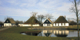
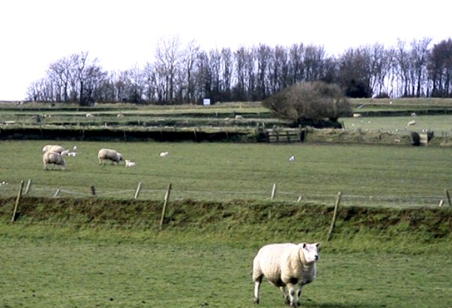
 |
 |
| Accommodation on Texel |
Texel 'the island of the sheep' |
7. Potentials
7.1 Spatial Planning
Regional spatial policy has identified the Hooge Berg as a ?landscape pearl?
which provides the oppertunity to promote cultural heritage management and
promotion.
7.2 Settlement
The settlement pattern with its varying pattern of historic villages and
towns is mostly intact and protected. However there is the opportunity via
planning requirements to promote the Cultural Heritage through careful
development in the appropriate style for each settlement.
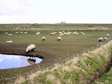
7.3 Agriculture
The rural development provides the opportunity to continue and promote
historic farming practices which would both provide further income for the
farmers, a tourist attraction and protect the historic landscape features.
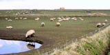
This could largely be based around the Texel Sheep. The promotion of the
Texel sheep and historic farming practices could promote and increase the
protection and management of historic landscape features such as turf banks
and aisled sheep sheds.
7.4 Management of cultural heritage
Texel has a rich archaeological heritage from the prehistoric period onwards
with the important Viking and later settlement at Den Burg, the port at
Oudeschild, fortification of Oude Schans and the other historic settlements.
The promotion of the Texel sheep and historic farming practices could
increase the protection and management of historic landscape features such
as turf banks and aisled sheep sheds. The fortified structures on the island
and the Georgian uprising also have the potential for promotion.
7.5 Tourism
Texel already has a thriving tourism industry and there is potential to
further promote the Cultural Heritage through the existing network of cycle
routes, walking routes etc. There is the potential to use the historic Texel
breed of sheep to promote products made from the animals which could also
encourage the continuation of the historic farming methods. The different
settlement types would also provide an interesting tourist route
7.6 Maritime History
The maritime history from the Viking period, through the construction of the
port facility at Oudeschild and the relationship with the East India Company
the maritime history of Texel has a high potential for promotion of the
cultural heritage of the island.
8. Sources
Marrewijk, D & A.J. Haartsen, 2002, Waddenland Het
landschap en cultureel erfgoed in de Waddenzeeregio, Ministerie van Landbouw,
Natuurbeheer en Visserij / Noordboek, Leeuwarden
Provincie Noord-Holland, 2004, Ontwikkelen met kwaliteit, ruimtelijke
samenhang op uitvoeringgericht, (streekplan) Ontwikkelingsbeeld
Noord-Holland Noord. Haarlem
|