|
1. Overview
|
Name: |
Vlieland |
|
Delimitation: |
Island in the Wadden Sea |
|
Size: |
40
km² |
|
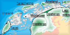
Location
- map: |
Province of Fryslân |
|
Origin of name: |
Related to the river Vlie. |
|
Relationship/similarities with other cultural entities: |
Relationship with Texel and Terschelling, neighbour islands. |
|
Characteristic elements and
ensembles: |
The island consist purely
of dunes with a settlement on the south-east side, duck decoy,
lighthouse. |

2. Geology and geography
2.1 General
Vlieland is one of the Frisian Wadden Sea islands off the northern
coast of the Netherlands that separate the Wadden Sea and the North Sea. The
natural landscape rose above sea-level after the last ice age. Since the
rise in sea level was accompanied by a higher fresh groundwater level, there
developed a zone parallel to the coast in which peat was able to develop on
a large scale. Clay and sand were deposited on this peat layer facing the
sea, while the peat on the landward side spread out over the more elevated
sandy areas. As a result of the flooding of the Strait of Dover, the sea
currents changed direction and began to run more parallel with the coast.
This gave rise to a series of low-lying dune ridges, broken by rivers
flowing into the sea. As a result of later incursions by the sea, the peat
behind the ridges was eliminated and the ridges were divided up into smaller
pieces, forming the Wadden Sea Islands. Vlieland bears the evidence for a
dynamic coastal area, where the erosion in some areas and depositions in
others, due to the strong sea currents have had a major influence on the
form the island has taken. Unlike the other three inhabited Friesian Wadden
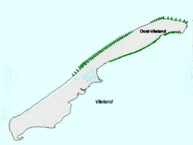
Sea islands, Vlieland does not have any salt-marsh polders. The island
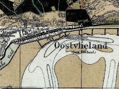
consists almost entirely of dunes, with a hamlet on the north-eastern side.
 |
 |
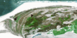
| Hamlet on the south eastern side of
Vlieland |
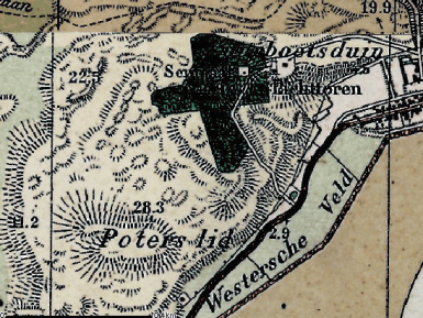
The highest dune in The Wadden Sea:
Vuurboetsduin |
2.2 Present landscape
On the other Wadden Sea islands the sand flats, main village and ferry
causeway are on the western side of the island and the extended beach and
dunes on the east, on Vlieland this is the other way round. The village is
in the eastern part of the island, and the natural landscape, in the form of
an extensive, barren plain and an elongated, narrow strip of dunes, in the
west and middle. The large quantities of sand on this Vliehors flat and the
prevailing westerly winds led to the formation of the highest dune on the
Wadden Sea islands: the 40-metre high Vuurboetsduin, on which the lighthouse
has been built.
3. Landscape and settlement history
3.1 Prehistoric and Medieval Times
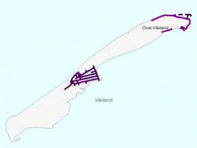
The earliest documentary reference to Vlieland is for 1317. For many
centuries Vlieland had two villages, but as a result of coastal erosion the
village of West-Vlieland slipped into the sea in the early 18th century.
Vlieland was formed thanks to intensive interaction between natural forces
and human action. People made use of the possibilities afforded by coastal
erosion and the deposition of sediment. The sand dunes were stabilised by
means of artificial planting and extra coastal defences were added where the
dune belt was particularly low or narrow. The island is subject to erosion
for almost the entire length of its North Sea coast, and short breakwaters
have been built along this coast in order to protect it.
 |
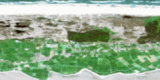
 |
| Dykes on Vlieland |
Coastal protection measures on
Vlieland |
3.2 Early Modern Times
In the 17th century the village of Oost-Vlieland grew because of the large
number of ships anchored in the lee of Vlieland waiting for favourable winds.
Vlieland played an important role in pilotage and provisioning for these
vessels. A lighthouse was built on the island to aid the passage of these
ships. There are a number of 17th-century properties in the village,
including the Tromphuis, which was formerly owned by the Admiralty and is
now furnished as a museum. In the 18th century the village of West-Vlieland
slipped into the sea.
Apart from shipping, important sources of income for the island economy were
the maritime trade and fishing, plus such activities as beachcombing and
smuggling. In contrast to the other islands, the lack of suitable
agricultural means that there is no farming practised on Vlieland. The
importance of maritime activities to the local economy changed with the
opening of the North Sea Canal (1876) and the advent of steam-shipping.
After a severe depression, the emphasis shifted from the 1920s onwards to
tourism. In addition, the military exercise grounds of the Ministry of
Defence provide work for some 20% of the current labour force.
 |
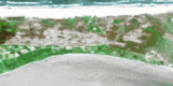
 |
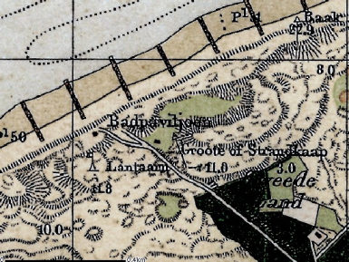
| Bath pavilion |
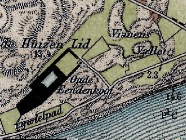
Duck decoy (eendenkooi) on Vlieland |
There is a duck decoy at Vianens Vallei on Vlieland, consisting of a lake,
the cage-pond and one or more tunnels. The area is surrounded by a wood or
swamp forest where ducks can rest on the water and take refuge from the
wind. These areas provide a contrast of green within the dune landscape.
Decoys were used in order to catch wild duck and similar fowl. Wildfowl
trapping was a traditional activity of cultural-historical value and the
decoys represent unusual, historic elements of the landscape where peace and
space are highly important.
3.3 Modern Times
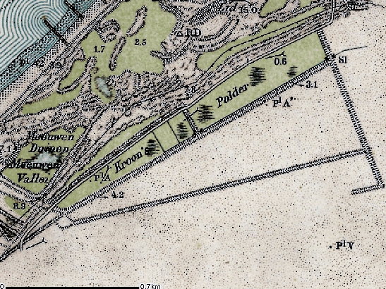
On the western side of the island, against the large sandflat known
as the Vliehors, are the Kroon's Polders.
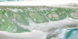
 |
Kroon's
Polder on Vlieland |
TThese formed in the early 20th-century and are now a nature reserve. The
Vliehors sandflat itself is a military training area. Like the other Wadden
Sea islands, Vlieland remains locked in a struggle with the sea. The
centuries-old battle against accretion and especially the erosion of land,
whereby the island appears to be ?walking?, continues unabated. However, the
principal danger to the village of the Oost-Vlieland was not water but sand,
which used to drift into the village, especially in winter. Around the turn
of the last century the situation became untenable. For the symbolic sum of
one guilder the municipality sold its wasteland to the National Forest
Service, which undertook the planting of a woodland to stabilise the sand.
After some searching and experimentation with the right tree species for the
previously treeless island, a wide belt of trees was planted around the
village between the two World Wars. Virtually all the land outside the
residential area is still owned by the National Forest Service.
4. Modern development and planning
4.1 Land use
The island of Vlieland differs from the other islands in the Dutch Wadden
Sea. It is small and it has an almost totally natural landscape. There are
no marshland polders, and only one very small area of agricultural land on
the island.
4.2 Settlement development
The only surviving village (there had been two villages in the medieval and
early modern period) is sited on the Wadden side with a harbour. Most of the
villages on the other islands have developed on higher grounds, on the
transition between the dune zone and the marshland. However the history of
habitation and cultivation of Vlieland differs from the other islands,
giving it its own unique character and the feeling of a place apart from the
rest of the world. The wide views, quietness and darkness are mentioned as
parts of the island?s unique selling points. Trade and fishery have left
their marks in the village, which is well kept, with many historic
structures. The first major extension to the village was built in the forest,
only recent houses are built on the north side on the higher grounds
(dunes). The good accessibility of many parts of the island by foot or bike
is an additional benefit to the tourism of the area. Tourist accommodation
is in the form of hotels and a lot of bungalows, which have their impact on
the dune landscape.
4.3 Industry and energy
Overall, more then 40% of the employment on the Dutch Wadden Sea
islands is directly related to tourism. On Vlieland tourism forms the
principal basis of the economy.
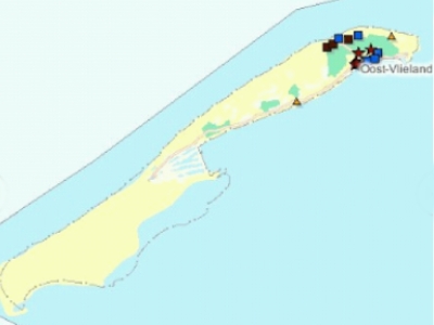 |
| Places of accomodation on Vlieland |
4.4 Infrastructure
Visitor's cars are not allowed on the island, there is a high density of
bicycles and footpaths.
5. Legal and spatial planning aspects
The Legal and Spatial Planning Aspects are described in a general way, as
these are relevant to all the cultural entities in the province of Fryslƒn.
Due to the scale of the cultural entities (which cover more then one
municipality), the focus is on regional policy and management. However, the
goals of the regional policy and planning strategy are taken into account by
the local sector planning policy. The regional goals and strategies are
formulated after discussion with a wide range of stakeholders and
organisations.
The regional spatial plan for the province of Fryslƒn, called Streekplan, is
an important document in terms of the integrated management of landscape and
heritage. This plan presents objectives for regional and local policy, as
well as considering issues of landscape and heritage. At this moment (mid
2006) the province of Fryslƒn is finalising her new regional spatial plan.
The essential qualities of the different landscapes of Fryslƒn are described.
These qualities are seen as important and should be taken into account when
making planning decisions. The recognition of the essential qualities of the
landscapes, and the strengthening of them, is a primary objective. The plan
(Streekplan) emphasises the need for protection of the historic landscape
and protection by development.
In provincial (spatial) policy, the Frisian islands have a special position
because of their very specific situation. The landscapes, the nature and the
cultural heritage is highly valued, and the space for development is limited.
The general vision for developments on the island is to look for
opportunities for improving the quality of the existing supply, instead of a
further extension of it.
6. Vulnerabilities
6.1 Settlement
Vlieland only contains a single surviving settlement, Oost-Vlieland, which
is under pressure to expand with the growth of tourism on the island. This
could detract from the historic core of the settlement if development is not
carefully planned.
6.2 Tourism
In some locations there is a need for upgrading and widening the quality and
appeal of the tourist accommodation. Discussion has started on how to design
and build recreational housing in the dunes. On Vlieland tourism is almost
the only basis for the economy which is therefore rather fragile. Lack of
investments in the quality of the tourist infrastructure can lead to a
decline of the tourist economy and therefore a threat to the maintenance of
the landscape and the cultural heritage of the island.
7. Potentials
7.1 Settlement
The settlement on the east side of the island, Oost-Vlieland, provides a
centre for tourism. Careful control of new buildings and expansion should
protect the historic core which retains its historic authenticity
7.2 Tourism
The island of Vieland is a popular place for family tourism. There is an
opportunity for investment in the quality of the landscape and cultural
heritage as this is seen to be important in attracting tourists. The policy
for sustainable tourism for the Wadden Sea islands supports the objectives
of quality and diversity. The cultural heritage of the island and in
particular its maritime history, provides opportunities for the creation of
cycle tours or walks around the island, especially when these are integrated
with promotion of the natural environment.
7.3 Maritime history
The settlement of Oost-Vlieland, developed as an early trading and fishing
centre providing the early economy of the island. The trading and fishing
industry provide a source for the potential promotion of the maritime
history of the area.
8. Sources
Marrewijk, D & A.J. Haartsen, 2002, Waddenland Het
landschap en cultureel erfgoed in de Waddenzeeregio, Ministerie van
Landbouw, Natuurbeheer en Visserij / Noordboek, Leeuwarden
Provincie Fryslan, 2006, Streekplan. Leeuwarden
|