|
1. Overview
|
Name: |
Westergo |
|
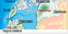
Delimitation: |
The
Westergo area is bordered to the north and west by the Wadden Sea and
the Ijsselmeer, the shallow lake formed when the Zuider Zee was closed
off from the sea by a dam. The southern and eastern boundaries are
formed by a system of dikes and a number of small lakes and waterways. |
|
Size: |
around
420 km² |
|
Location
- map: |
Province of Fryslân |
|
Origin of name: |
The north part of Fryslân was departed by the Middel Sea. The island on the west side is Westergo. |
|
Relationship/similarities with other cultural entities: |
Adjacent to Oostergo and
Middelzee, linked to Wieringen by the Ijsselmeer Dam. |
|
Characteristic elements and
ensembles: |
Westergo contains the
most extensive collection of dwelling mounds (terpen and wierden) in
the Netherlands. Clustered dwelling mounds and in rows; dense
groupings of water ways and former seawalls; historic field patterns,
in particular radiating out from around dwelling mounds; very open
landscape; medieval town centres and villages, Romanesque churches,
historic farming buildings, brick houses (stinzen). |

2. Geology and geography
2.1 General
The history of the area dates back to the last ice age, when the
glacial melt-waters caused rising sea-levels, in turn pushing up groundwater
levels. This caused peat to develop in a zone parallel to the coast. On the
seaward side of this peatland a line of barrier bars and islands developed.
These were subsequently breached by the sea in a number of places, breaking
them up into smaller units, forming the Wadden Sea islands. The area between
the barrier islands and the peatland was an intertidal zone of sand flats,
tidal channels and salt marshes, which were inundated by seawater twice a
day.
When the first inhabitants colonised the area there was a creek which
penetrated deep inland, into which the river Boorne flowed. This creek
slowly silted up and a new sound was created, the Middelzee, which served as
an estuary for the Boorne.
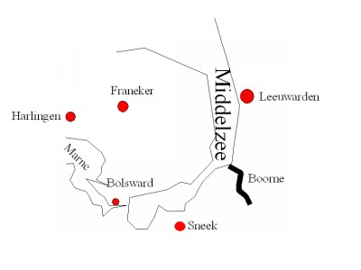 |
Westergo
and Middelzee with river Boorne |
Sediments were deposited along the banks of channels, forming low levees. Behind these banks were lower-lying relatively flat expanses of mudflats. To the north of Westergo a number of long salt marsh banks can be seen in the landscape running parallel to the coastline. Through the accretion of sediments the coastline shifted a number of times in a northward direction. The most southerly salt marsh bank is therefore the oldest; those lying further north are increasingly younger. The transitional zone between the sea clay landscape and the peat landscape lies to the south of Westergo.
2.2 Present landscape
Sediments were deposited along the banks of channels, forming low levees.
Behind these banks were lower-lying, relatively flat expanses of mudflats.
To the north of Westergo a number of long salt marsh banks can be seen in
the landscape running parallel to the coastline. Through this accretion of
sediments the coastline has shifted a number of times in a northward
direction. The most southerly salt marsh bank is therefore the oldest; those
lying further north are increasingly younger. The transitional zone between
the sea clay landscape and the peat landscape lies to the south of Westergo.
3. Landscape and settlement history
3.1 Prehistoric and Medieval Times
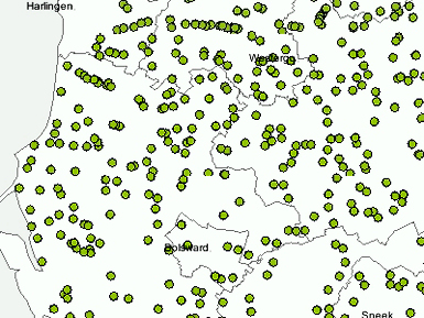
The earliest settlements were on the highest areas of land: the elevated (supratidal)
salt marsh flats in the south-east, the salt marsh banks in the north and
the levees along the Middelzee, the Marne and the smaller creeks. As soon as
enough sediment had accumulated to raise a salt marsh high enough for it to
become dry land, it appears to have been settled. However, the continuation
in rising sea levels made it necessary to further artificially raise the
ground level of these settlements. The sites were built up by adding manure
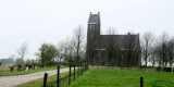
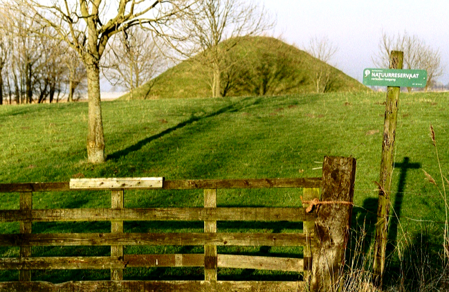
and clay sods to create dwelling mounds, called ‘terps’.
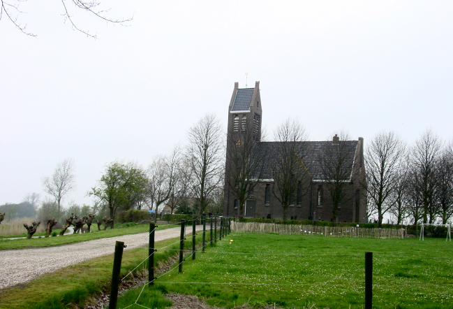 |
| Photo: Dwelling mound (terp) with
church in Westergo |
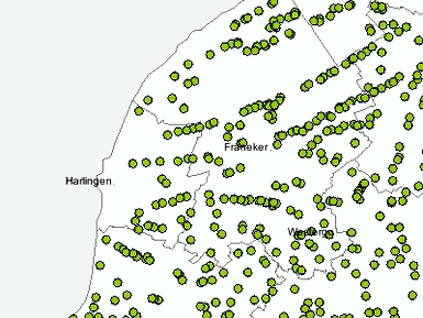
The terp
villages in the southern part of Westergo often have an irregular field
pattern and the farms are dispersed over the area. In the northern part of
Westergo, the field pattern is more regular and rectangular. Some of these
terps were located on levees along creeks or sea inlets so that boats could
moor alongside them. These terps, which have an oblong shape with buildings
along both sides of a long road, were built for trading purposes, as opposed
to the older dwelling mounds which were constructed primarily for farmsteads.
Many terps lost their raison d?ˆtre when dikes were built.
 |
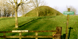
 |
| Dwelling mounds in the south of
Westergo.. |
and in the north |
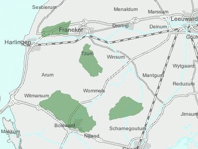
One of the most
striking features of the cultural history of Westergo is its dike system.
This area contains the oldest dikes in the Netherlands. The first dikes were
low and built to protect a farm or a few arable fields. In the 10th century
increasingly large areas were surrounded by ring dikes: the memmepolders, or
'mother polders'. Creeks within the enclosed ring were dammed and fitted
with sluicegates to control drainage. These mother polders then formed a
basis from which additional areas of land were enclosed by dikes, which were
built perpendicular to the older dikes around the mother polders.
 |
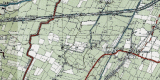
 |
| Memmepolders or 'mother polder' |
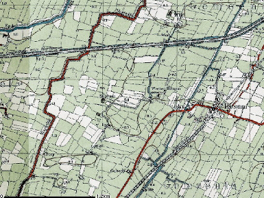
Map of 'sleeping' or back dykes |
As this
extensive system of dikes grew, many of the earlier dikes lost their
function as sea defences and became 'sleeping dikes', or back dikes. A
sleeping dike is a flood barrier that is only needed if the primary
water-retaining structure, the sea dike, is breached. Many sleeping dikes
have fallen into disrepair over the years and have been dismantled.
Nevertheless, some remain and are still visible in the landscape, such as
the Griene Dijk and the Slachtedijk.
 |
 |
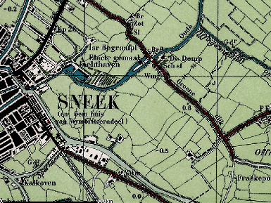
| The Griene Dijk near Sneek |
The Slachtedijk |
Clay was
excavated from other sites for the manufacture of bricks. These sites are
still marked out in the landscape by the abrupt differences in ground level
between the excavated areas and the surrounding land. 'Crown-shaped plots'
can be seen in some places. These were created by digging up the soil from
the edges of the plot depositing it in the middle to improve drainage and to
spread the risk of crop failure: in wet years the highest parts of the
arable plots produced the greatest yield; in dry years the lower areas were
more productive. In Westergo livestock farming has always been the principal
agricultural activity. Arable farming was only possible on the elevated,
drier salt marsh banks.
 |
Crown
shaped plots in Westergo |
3.2 Early Modern Times
The dikes were originally built to keep out the sea, but from the 11th and
12th centuries onwards they were built to reclaim land. Before this time
parts of Westergo were regularly inundated by the sea and areas of land were
washed away. The results of these attacks on the coastline area are clearly
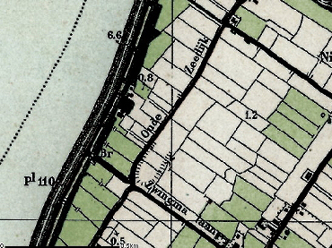
visible in the irregular, notched shape of the Zuider Zee coastline. In
other places the dikes were breached, leaving behind pools scoured out by
the seawater as it gushed through the breach. The dikes were repaired by
rerouting them around the pools and so in time they acquired a winding and
bendy shape.
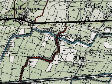
 |
Map with
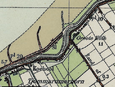
pool remnant after dyke breach (Kolk) |
The function of
the trading terp villages, which lost their open connection by water with
the Wadden Sea because of the construction of continuous dikes and
reclamation of the sea inlets, was taken over by the dam and lock villages (zijldorpen)
which grew up around the dike locks (zijlen). In total about 700 dwelling
mounds and terp villages were built in Westergo. At the end of the Late
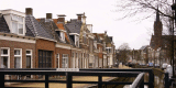
medieval period there were five towns in Westergo: Bolsward, Workum,
Harlingen, Franeker and Hindeloopen. These towns still have their well kept,
historic town centres.
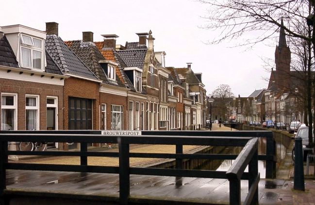 |
| Photo: Town center of Bolsward |
From the 19th
century the dwelling mounds or terps were quarried as a source of rich soil
to fertilise the arable fields. The buildings on them were often demolished
and rebuilt after the mound had been excavated. Only the steep cuttings and
fragmented remnants of the villages are still visible in the landscape,
evidence of the large-scale excavations.
Westergo has not only fought a running battle with the sea; controlling the
water inland has also presented a problem. After the construction of the
dikes, natural drainage was no longer possible, and numerous canals, such as
the Zwette, were dug. In addition natural watercourses were adapted and
sluices built. In the south-west a number of shallow lakes were reclaimed by
pumping out the water. There are three large and several small reclaimed
lakes. The regular small-scale field pattern of the larger reclaimed lakes
are in clear contrast to the surrounding irregular, rectangular field
patterns.
For a long time, water was an important means of transport. The natural
landscape contained a fine network of channels, gullies and creeks, some of
which were connected and used for drainage and navigation. In the 17th
century a network of through waterways (trekvaarten) were built. Existing
canals between the main towns were widened and deepened and towpaths
constructed along one or both sides, e.g. the Harlingertrekvaart.
 |
 |
| Waterways with trek paths (trekvaarten)
in Westergo |
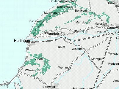
Map of Harlingertrekvaart |
For a long time
overland transport was limited to unpaved roads on the dikes, the towpaths
and the higher parts of the salt marsh banks, but at the end of the 19th
century the country roads were supplemented with not only a rail network but
also a number of tramways and local railways. However, the tramways and
local railways soon fell into disuse when buses and lorries appeared on the
scene. The routes of many of these tramways and railway lines can still be
seen in the landscape in the form of railway embankments and the lines of
field boundaries.
An important cultural and historical feature of Westergo are the brick
houses (steenhuizen or stinsen). Originally these were single defensible
brick towers, built on mounds (stinswier) and surrounded by a moat and an
earth rampart. They initially served as places of refuge, but later on more
habitable buildings were built (zaalstinsen). The only three remaining
examples of these early brick buildings have been converted into country
houses.
 |
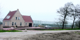
| Photo: 'Stinswier' in Menaldum |
3.3 Modern Times
In many places the original field pattern has been altered or lost as a
result of land re-allotment schemes carried out during the 20th century. As
transport technology developed at a rapid pace during the 20th century, land
transport gained in importance at the expense of water, in spite of the
enlargement of some of the major canals connecting the harbour town
Harlingen with Leeuwarden and Groningen (van Harinxmakanaal). Many new roads
were built, but the numerous lakes and waterways outside the entity, have
always hampered the expansion of the road network. Most of the old brick
buildings (the stinsen) have been demolished to make way for farms. However,
many of the old moats have left their imprint in the landscape, and tall
trees still mark the locations of these early towers and manor houses.
4. Modern development and planning
4.1 Land use
Most of the land in Westergo is under agriculture, specializing in
dairy farming. In the northern part of Westergo near Berlikum there is a
concentration of greenhouse farming. The area was, and is, very suitable for
agriculture and planners anticipate that agriculture will remain the
principal land use activity.
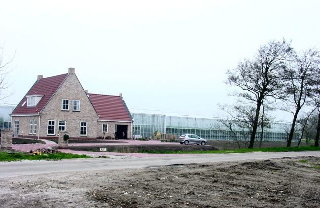 |
| Photo: Greenhouse farming in
Berlikum |
4.2 Settlement development
The villages on dwelling mounds are still recognizable. Nearly all the
villages and the historical towns have new building developments on the
fringe, some of which badly fit into the old structure and landscape.
However, more attention is now paid to planning and building developments so
that they integrate better into the cultural and natural landscape.
4.3 Industry and energy
Near the old towns, particularly the harbour town of Harlingen, business and
industrial parks have developed. Between Harlingen and Franeker the strip
along the canal has been progressively infilled with industrial buildings.
In addition, the larger villages all have their own business-parks.
The open landscape, combined with the windy climate, makes Westergo a
suitable area for wind-generated energy. Early policy encouraged the
erection of individual small wind turbines near farmsteads. This policy has
changed to the encouragement of concentrations of windmills in wind-farms.
Industry was originally agriculturally-based, but this link is becoming less
important. The harbour of Harlingen is the location for a few big companies
and a gas transition plant.
4.4 Infrastructure
The highway from Leeuwarden to Harlingen and the motorway from Harlingen to
the enclosure dike (Afsluitdijk) are the most important transport links,
being the fastest connection with Amsterdam and the surrounding area. There
are two rail connections within the entity: Leeuwarden-Harlingen and
Leeuwarden-Sneek, mainly used for passenger transport. As in the past,
waterways are still important in this area, but apart from the main canal
from Leeuwarden-Harlingen, they are now particularly significant for tourist
traffic.
5. Legal and spatial planning aspects
The Legal and Spatial Planning Aspects are described in a general way, as
these are relevant to all the cultural entities in the province of Fryslƒn.
Due to the scale of the cultural entities (which cover more then one
municipality), the focus is on regional policy and management. However, the
goals of the regional policy and planning strategy are taken into account by
the local sector planning policy. The regional goals and strategies are
formulated after discussion with a wide range of stakeholders and
organisations.
The regional spatial plan for the province of Fryslƒn, called Streekplan, is
an important document in terms of the integrated management of landscape and
heritage. This plan presents objectives for regional and local policy, as
well as considering issues of landscape and heritage. At this moment (mid
2006) the province of Fryslƒn is finalising her new regional spatial plan.
The essential qualities of the different landscapes of Fryslƒn are described.
These qualities are seen as important and should be taken into account when
making planning decisions. The recognition of the essential qualities of the
landscapes, and the strengthening of them, is a primary objective. The plan
(Streekplan) emphasises the need for protection of the historic landscape
and protection by development.
6. Vulnerabilities
6.1 Spatial Planning
The open space, skyline and structure of the historical cities, towns and
villages are very vulnerable to ill informed planning for new housing and
industry. This is especially the case in the economic development zone
between Harlingen and Franker and in the cities themselves (i.e. the
extension of the harbour of Harlingen).
6.2 Settlement
The social economic situation makes industrial development a priority in the
region; specifically in the Harlingen-Franeker area, which is part of the
Westergozone, and in Leeuwarden. In the Westergozone the focus of new
housing and industrial development should be Harlingen and Franeker, both of
which should remain identifiable as separate towns. Other settlements have
room to further develop their industrial and housing estates resulting in a
loss of agricultural land. New housing also requires more space. Cultural
assets within these areas will be vulnerable to change. Many of the smaller
settlements that had been on mounds have already been lost to agricultural
improvements.
6.3 Agriculture
The historic field pattern, natural watercourses and the historic farm
buildings are vulnerable due to agriculture developments. Within the
framework of landscape core qualities there is room for large-scale
agriculture and more intensive farming (greenhouse horticulture) with the
associated innovative systems. Changes in the agricultural sector will bring
new forms of building (new building mass) and the release of valuable farm
buildings. The latter will be vulnerable to change and will require new
creative uses while conserving the building?s characteristic features.
6.4 Energy and Industry
The move towards wind power with more concentrated wind turbines may pose a
threat to below ground archaeological deposits and the visual amenity of the
wider landscape.
7. Potentials
7.1 Spatial planning
The proposed residential and industrial development should consider the
cultural heritage, both in terms of recording prior to development and
management of known sites. Within the historic core of the towns and cities
careful planning should protect the historic layout and surviving buildings.
7.2 Settlement
Many historic settlements survive and these could be promoted for tourism.
The dispersed settlement pattern of small villages and farmsteads have the
potential to be promoted via tourism for their cultural heritage.
7.3 Agriculture
Sustainable agriculture in relation to meadowland, migrating birds and
cultural historical elements contribute to the development of tourism. There
is potential for disused agricultural buildings to be used for new housing,
holiday accomodation or new small scale industrial enterprises.
7.4 Tourism
The area has clear potential for landscape and cultural history tourism. The
use of historic buildings and farmhouses for accomodation, old paths for
walking and cycling and old water ways for pleasure shipping is already
practised and should be promoted further. The restoration and management of
cultural features will encourage a wider interest via tourism in the area.
One of the most striking features of Westergo is the dike system which has
the potential to be promoted as a significant tourist attraction especially
for walkers and cyclists.
7.5 Maritime History
The specific qualities of Harlingen as a port can be used to promote the
maritime history of the area. This could be linked with the important canal
system which can be promoted via tourism.
8. Sources
Marrewijk, D & A.J. Haartsen, 2002, Waddenland Het
landschap en cultureel erfgoed in de Waddenzeeregio, Ministerie van Landbouw,
Natuurbeheer en Visserij / Noordboek, Leeuwarden
Provincie Fryslan, 2006, Streekplan. Leeuwarden
|