|
|
|
|
|
|
|
Cultural Entities
|
 |
|
|
Bökingharde |
|
|
|
|
||||||||||||||||||||||||||||||||||
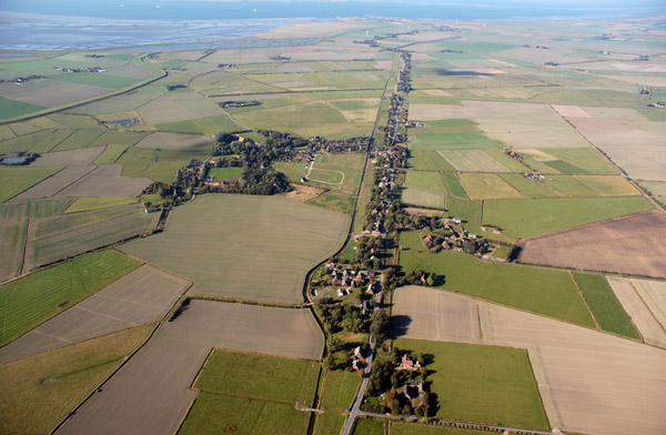
The extension of settlement in the old salt marshes is unknown, as this landscape was destroyed by storm surges especially in the 14th century, but the rising water level probably forced the settlements to recede to the higher situated bogs on the Ice Age remnants of Risummoor, which were then cultivated and turned into agricultural land. Risummoor and some patches of salt marshes, like Fahretoft, remained as islands surrounded by mud flats and tidal inlets. In order to use adjacent marshland areas for grazing villages and farmsteads were arranged along the edge of Risummoor. Its delimitation is therefore still mirrored by villages like Maasbüll, Risum-Lindholm and Klockries, a pattern that is typical for all medieval settlements along the edge of the Geest in the area, going hand in hand with the erection of dwelling mounds in this case, owed to the comparatively low situation and the increasing water level. The connection of Risummoor to the mainland nearby was achieved again only in the late 15th century with the polders of Klixbüller Koog and Großer Kohldammer Koog. Earlier ring dikes, protecting parts of the island, were combined to a surrounding embankment in the 16th century. The island became the Kornkoog polder after the Gotteskoog dike connected the Horsbüllsharde in the north-west to the mainland. The influence of the sea on the island, which was now impeded to stream freely, increased substantially as Risummoor was partially incorporated in the dike. In contrary, a number of larger Hallig islands like Dagebüll, Fahretoft and Waygaard existed in the west, between the former island of Horsbüllsharde and the Hallig of Oland, which remained unprotected till the 18th century. Comparable to modern Hallig islands like Hooge and Gröde, people erected their farms and villages on protective mounds encompassed by stretches of salt marshes. Other such Hallig islands, situated more eastward, can only be derived from names like Hasenhallig or Schäferhallig and from old maps, which reconstructed the area not as open as the modern Wadden Sea with their Hallig islands but rather as salt marshes frequently intersected by tidal inlets, of which the lake Bottschlotter See is a remnant.
The early modern field structure of irregular shaped fields surrounding mounds, oriented along the course of tidal inlets, is still especially well preserved around Fahretoft and
Süderwaygaard.
A Gallows mound can still be seen in
Risum-Lindholm. New polders south of Risummoor and the Lecker Au were embanked in the 15th and 16th century, like the
Störtewerker Koog, shifting the line of the outer sea walls further west. The neighbouring island of Waygaard was the first of the Hallig islands to be surrounded by a dike.
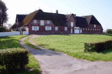
It was in the decades before, when also new land was reclaimed from the polders of Kornkoog, Gotteskoog and Wiedingharder Alter Koog in the north-west, which were also in need of further protection by an additional dike line. These new polders, like the Kleiseer Koog and Alter Christian-Albrechts-Koog, were systematically planned, as land reclamation was now financed by private investors or the nobility (Oktroi). The internal fieldscape consists therefore of more rectilinear, elongated fields oriented towards farmsteads on low mounds, lined up along central roads. Especially the Alte-Christian-Albrechts-Koog, as the oldest of these polders, still retains most of this early modern pattern with less rectilinear field boundaries and many old farmsteads, typically surrounded by ditches for clay extraction (Graften). The fertile new marshland brought wealth to the farmers, which is represented in abundance by large farmsteads of the Uthlande type, usually extended into four-sided or five- and seven-shaped structures, like the Hof Gottesberg situated in the Kleiseer Koog.
The
Nahnshof in the Christian-Albrechts-Koog hosts a wellness hotel today. About the time, new settlers from the Netherlands, whose expertise was needed for dike construction, introduced large farm building types as Haubarg, Gulfhaus and Bargscheune built around massive central posts, like the
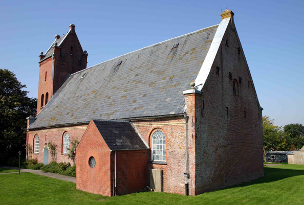
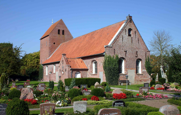
Königsteiner Haubarg, as well as their technically advanced windmills. New, simple, brick-built churches with Baroque interior substituted the former, small Hallig churches, like in
Dagebüll or
Faretoft. The still unprotected island of
Galmsbüll had to be eventually abandoned and a new church was only raised at the end of the 19th century, further inland, as a representative, neo-gothic building. The reclamation of the
Marienkoog in 1798 finished the historic development of the coast line of the Bökingharde, which had turned an open area of mixed and ever changing mud flats, marsh islands and tidal inlets into a part of the mainland marshes.
A large number of polder mills had to drain the adjacent land. The Lecker Au was also eventually embanked and led through a straight canal across the Störtewerker Koog. The drainage situation however remained rather poor. Even the usage of the Bottschlotter See as water reservoir at a later stage could not substantially improve the situation until after World War
Two.
According to a doctrine during the national socialist regime, new land had to be gained. Two small polders were therefore reclaimed for the first time after over a hundred years. The
Galmsbüller Koog and the
Osewoldter Koog display a geometric field system arranged, together with farmsteads in a pseudo traditional style, along a central road. The
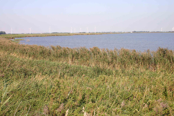
Hauke-Haien-Koog was mostly embanked for coastal protection reasons as last polder in 1959, and is divided in two parts. The easternmost half is used for agriculture by a few new farms, while the seaward part is a nature sanctuary and reservoir for the inland water. The new harbour of Schlüttsiel on the sea dike of the polder, were the Bongsiel canal flows into the Wadden Sea, serves today as a connection to the Hallig islands and for fishing vessels. The often inundated, low lying inland polders have been drained with increasing success from the 1930ies on, especially since the Hauke-Haien-Koog was reclaimed. New farmsteads have been built systematically afterwards, like in the
Störtewerker Koog, and land could be used for agriculture, which led to a very modern appearance of these old polders. Likewise, the Programm Nord and modern industrialised agriculture have chanced the appearance of the traditionally small scale fields and pastures in many parts of the area considerably since the 1960ies into larger, more uniform structures. Ditches were either straightened or filled up as modern, intensive cultivation required larger and more rectilinear fields. Many farms, which now had to cater for their larger estates, were in further need for additional farm buildings, leading to ensembles of modern barns and stalls, dwarfing and hiding the older buildings. Other farms were abandoned or turned into apartments for tourists. This development is still in
progress.
4.1 Land use The Programm Nord and modern, industrialised agriculture have chanced the appearance of the traditionally small-scale fields in many parts of the area considerably into larger, uniform looking structures and fewer, straightened ditches since the 1960ies. Some farms have been in further need for buildings in order to cater for their larger estates, leading to ensembles of modern barns and stalls, dwarfing and hiding older buildings, while others were abandoned or turned into apartments for tourists. The western part of Hauke-Haien-Koog is a nature sanctuary and reservoir for the inland water. 4.2 Settlement development The industrial estates and new housing areas have spread the town area of Niebüll extensively into its vicinity in recent decades, like into the Gotteskoog. New residential areas have also been built in Dagebüll, which is now focus area for tourism. The whole of the entity of Bökingharde is rated as tourist and recreational area. The actualisation of the regional plan therefore restricts further planning for tourism related buildings and infrastructure. Developing areas around Niebüll as centre of regional development are likely to further increase in the near future. However, population in the area is expected to decrease in the long term. 4.3 Industry and energy Wind turbines have been erected during the last decades, mostly in polders of early modern or modern origin. These areas are still designated as suitable for wind turbines, whereas the Hauke-Haien-Koog, Langenhorner Koog and Störtewerker Koog as well as the lowland along the Soholmer Au River has to be kept free from wind power systems. 4.4 Infrastructure Roads are mostly based on historic routes and connections between settlements and often built on top of former sea walls. The harbour of Dagebüll is the major port to the moraine islands. A narrow gauge railway connects the Hallig islands of Langeness and Oland to Dagebüll, but can only be used during low tide. 5. Legal and Spatial Planning Aspects The whole entity is a planning area with special interest for tourism and recreation. Parts of the landscape are recognized as characteristic and typical for the area, like the polders of Störtewerker and Langenhorner Koog as well as the flood plains along the Soholmer Au. The Hauke-Haien-Koog, marshes around Fahretoft, Langehorn and the Bottschlotter See fulfil requirements for nature protection areas. The area around Fahretoft, Langenhorn and Ockholm is suitable for landscape protection. The town of Niebüll is already focus area for monument protection. Several ponds caused by dike breeches are listed as geological important. However, no new protection areas are planned to be implemented in North Frisia. Nature protection rather aims at further integrating agriculture and promoting extensive stock breeding and contract based nature protection, as it is done in the Hauke-Haien-Koog. Furthermore, it is suggested to raise the number of so-called typical landscape elements and to integrate existing elements into the network of biotopes and protection areas, like the Bottschlotter Tief. The landscape plan supports the integration of historic settlement structures into planning. The tourism concept for North Frisia promotes a sustainable development in this sector. An improvement of landscape related tourism together with riding, cycling and hiking is suggested by landscape planning. 6. Vulnerabilities Agriculture is economically still very strong, as is common for the area, with a focus on dairy products and cultivation for feeding stuff. The farms are of fairly large size with no specialisation advantageous for the historically small-scale field structure. Niebüll suffers, as train gateway to Sylt, from seasonal car traffic predominantly caused by short-term visitors. The harbour of Dagebüll has turned into a ferry port with expansive parking areas and up-to-date facilities and buildings with no relation to traditional harbour structures, veiling more and more, together with the modern residential areas, the origin as a Hallig island. Further plans for consolidation of farming, especially new agrarian roads and enlargement of fields, could affect the landscape character in a negative way. The creation of a nature-related habitat by TEN (Transnational Ecological Network) could alienate structures from their original, artificial character. 7. Potentials The original village structure is mostly intact, except for Niebüll. The area is especially suited for cycling. Long term recreational tourism and especially landscape related offers for tourists could be strengthened by integration of cultural landscape assets, taking into account the unique situation of numerous former Hallig islands being integrated into the mainland marshes. More traditional farmsteads, not used for their original purpose, could be implemented as tourist and recreational facilities. 8. Sources Author: Matthias Maluck General literature: Vollmer, et. al. (eds.) 2001. Landscape and Cultural Heritage in the Wadden Sea Region – Project Report. Wadden Sea Ecosystem No. 12. Common Wadden Sea Secretariat. Wilhelmshaven, Germany. Innenministerium des Landes Schleswig-Holstein (eds.) 2004. Regionalplan für den Planungsraum V, Amendment File. Ministerium für Umwelt, Natur und Forsten des Landes Schleswig-Holstein (eds.). Landschaftsrahmenplan für den Planungsraum V. Kiel 2002. Kunz, H. & Panten, A. 1997. Die Köge Nordfrieslands. Bredstedt. Bantelmann, Landschaft und Besiedlung Nordfrieslands in vorgeschichtlicher Zeit (Husum 1992) Bantelmann, A. (ed.) 2000. Das große Nordfrieslandbuch. Bredstedt. Gemeinsames Wattenmeer Sekretariat (ed.) 2005. Das Wattenmeer. Theiss Verlag Stuttgart. Beseler, Kunst-Topographie Schleswig-Holstein (Neumünster 1969) Braun, Strehl (eds.), Langhaus und Winkelbau. Uthlandfriesische Bauformen im 18. und 19. Jahrhundert (Bredstedt 1989) Vogel, Der nordfriesische Geestrand, die Entwicklung seiner ländlichen Siedlungen und ihrer Flurformen (Bräist/Bredstedt 1996) Fahrenkrug et. al. Regionales Entwicklungskonzept Nordfriesland (unpublished, 2003) Maps: Archaeological monument record of Schleswig-Holstein and gis mapping Lancewad data base and gis maps Royal Prussian ordnance survey of 1879 Map of H. du Plat of 1804/05 Comments: The area has good potentials for tourism due to its singular former Hallig landscape.
|
a.jpg)
a.jpg)
a.jpg)
a.jpg)
a.jpg)