|
1. Overview
|
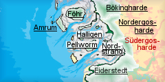
Name: |
Südergosharde |
|
Delimitation: |
Arlau
river, entity Nordergosharde in the north, Mühlenau river, entity Südermarsch
in the south, Beltringharderkoog as connection to entity Nordstrand in
the northwest, Wadden Sea in the southwest, eastern border of
municipality of Husum, Schobüll, Wobbenbüll |
|
Size: |
~110 km²
(11x10)km² |
|
Location
- map: |
Wadden Sea Area of North Frisia, Schleswig-Holstein, Germany |
|
Origin of name: |
Name
of former Danish political unit, entity comprises only western parts
of the area |
|
Relationship/similarities with other cultural entities: |
Single
dwelling mounds and few village mounds like Wiedingharde, farm land
divided by hedgerows like Föhr |
|
Characteristic elements and ensembles: |
Irregular
medieval and early modern field system, high medieval farm mounds and
groups of mounds, some on dunes, dike mounds, farm houses within large
medieval polder, uninhabited small-scale polders, historic old centre
of Husum with medieval layout, Renaissance and Baroque houses, castle,
classicistic building in adjacent areas, late 19th century forests,
villages with large modern residential areas, small-scale fields
divided by hedgerows. |

2. Geology and geography
2.1 General
Pleistocene moraines from the Saale ice age form the high geest of North
Frisia were the town of Husum and the Geest of Schobüll is situated, the
ground of the latter rising up to a height of more than 30m. In the Südergosharde,
the moraines of the mainland reach the coast and slope directly down to the
mud flats of the Wadden Sea without any salt marshes in front, a situation
found rarely in the Wadden Sea area. Small marshland areas accumulated north
and south of this place around the rivers of Arlau and
Husumer Mühlenau,
originating from glacial rivers of the ice age. The proceedings and retreats
of the sea during the centuries also produced layers of turf under the
modern marshland as well as some dunes, which were later incorporated into
the developing salt marshes. During the Middle Ages these probably belonged
to a much larger salt marsh area which was mostly destroyed by severe tidal
floods from the 14th century on.
2.2 Present landscape
In the north, the entity of Südergosharde consists of the marshland area of
Hattstedtermarsch south of the Arlau river, already originating in the
Middle Ages and characterised by an irregular small scale field system
mostly used for animal breeding and only few, scattered farmsteads on mounds
mostly in the western part.
|
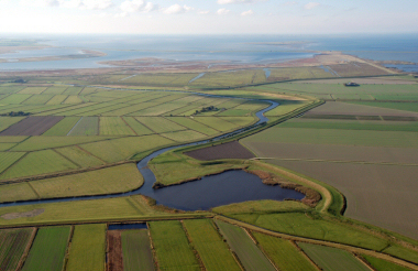 |
 |
|
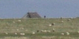
Arlau and Wehle (foreground). On the left side
(south) of the Arlau the Hattstedtermarsch with small and irregular
field pattern on the right side (north) big fields of the Reußenköge
from Modern Times. ©
ALSH |
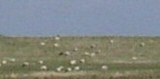
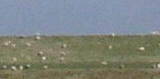
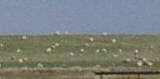
View from
the Hattstedtermarsch to the Reußenköge in the north.©
ALSH |
The polder is cut by the coastal road and a
railway line which also extend southward, across the Geest at Hattstedt,
till Husum. Trees are lined up along roads and are set around farmsteads.
The high moraine Geest, with its relief sloping up to the hill at Schobüll,
is rather densely settled by growing villages along the edges to the
marshland and has some forested areas in the hinterland while much of the
land outside the villages is intersected into small fields by hedgerows,
mostly used for farming. The city of Husum dominates the southern part of
this area with its historic centre and the vast modern residential and
development areas especially in the northwest. The mostly uninhabited
polders west of Husum, delimited by the Mühlenau river to the south, are
small and consist of irregular fields used for grazing.
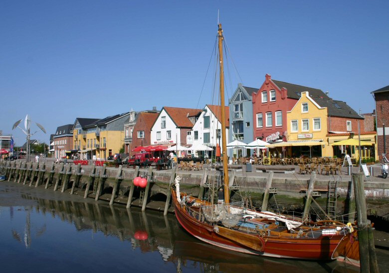 |
|
Husum harbour.
© ALSH |
3. Landscape and settlement history
3.1 Prehistoric and Medieval Times
Finds
from late Mesolithic Times below the Porrenkoog at Husum are exceptionally
early human traces for the Wadden Sea Area and very rare. More recent are
settlements and burials of late Stone Age origin on the glacial fringe, but
also Neolithic traces on dunes in the Hattstedtermarsch. Burial mounds and
urn cemeteries on the moraine area are usually from the Bronze Age.
Extensive salt marshes and bogs probably existed in the area from the Iron
Age on, but were mostly destroyed in the late Middle Ages. The marshland in
the east of the Hattstedtermarsch originates from the time and was used for
grazing by farmers settling on the adjacent Pleistocene high land. Some
villages like Bohmstedt and
Ahrenshöft, still show the typical structure of
settlements along the edge of the Geest using the low and wet salt marshes
for animal breeding, while others, like Hattstedt and
Horstedt have a more
clustered structure indicating another subsistence basis. Intensive land use
turned most of the land on the Geest into heath land and cut away the early
forests already in the Middle Ages. The oldest building in the area is the
church of Olderup, a simple hall church, probably from the 12th century,
with a later added, detached belfry. The entrance on the side is also
typical for indigenous farm houses. The village of Husum already existed at
the time but especially began to flourish after the flood in 1362 had
destroyed large parts of the former slat marshes and the tidal inlet of
Heverstrom made its way to the Geest at Husum and has connected it
henceforth to the open sea.
The western parts of the Hattstedtermarsch were higher and more fertile than
those in the east but much more under the direct influence of the sea and
consequently divided by tidal inlets. Settlement here started again in the
12th century on dunes like Sterdebüll or
Herstum, which had also
subsequently been raised artificially or on mounds or groups of mounds, like
the mounds of Ellerbüll. The old course of the
Arlau used to be different
in high medieval times from what it is today but can still be traced. The
Jelstrom canal still mostly follows its original course. Yet, when the salt
marshes along the Arlau were embanked in the late 15th century, it already
resembled more or less its modern course. The small scale field system of
the Hattstedtermarsch polder has not been changed substantially throughout
the ensuing centuries and can still be regarded as fairly medieval. The
small area of low salt marshes in front of Husum was embanked in the late
15th century and has stayed almost uninhabited till today and was only used
for animal breeding and mowing, as it was wet and became frequently flooded.
Even though land reclamation has gained much new marsh land, large areas
were lost to the sea, like the area of Warfthusen in front of the
Hattstedtermarsch.
3.2 Early Modern Times
The
economy of Husum boomed in Early Modern Timess due to its role as important
harbour for shipping grain from the region, resulting in an abundance of
rich buildings, which were erected in the 16th and 17th century, such as the
birth place of the writer Theodor Storm, some houses in Hanseatic style or
the town hall of 1601, in the old
town centre. The duke's castle
in Dutch renaissance style was at that time built outside the confines of
the city. North of the harbour the layout of Husum has been oriented towards
the mouth of the Husumer
Au, already dammed in the 15th century and along
the westward roads to Flensburg and
Schleswig
and the northward road to Niebüll. Later centuries erected their
residential buildings around this centre and especially between old town and
castle. The town was granted city rights in 1603. The severe flood in 1634
led to a decreasing trade. In addition to rising sedimentation in the
harbour area this resulted in economic problems and an economic decline
during the 17th and 18th century. A couple of water mills dammed up rivulets
around Husum, notably the Mühlenau.
The outline of the resulting pool can still be traced in the layout of
streets and as slope west of the harbour, south of the actual river.
Consolidation of farming in the 18th century divided the commons among the
farmers via banks with hedgerows
into small scale fields used for mixed farming. A system which still can be
seen frequently today, e.g. near Wobbenbüll. Around the large Halbmond
pond south of the Mühlenau river, a dike breech of late 15th century origin,
several fortifications were built during the time and destroyed again
leaving only little traces.
 |
|
Halbmond pond south of the Mühlenau
river.
© ALSH |
3.3 Modern Times
A railway track to Niebüll in the north was built in the middle of the 19th
century, cutting the marsh land area of attstedtermarsch in half, and later
extended to Hamburg in the south. The heath land on the moraines was turned
into forest at several places due to improved fertilising techniques, like
behind Schobüll, east of
Wobbenbüll or at Osterhusum. Gravel was exploited
as fertilizer in pits like on the Mauseberge hill in Husum, now a park
outside the city. The classicistic Marienkirche was built around 1830,
resembling the cella of an antique temple. Whereas Husum had not extended
its confines considerably by the end of the 19th century, it grew rapidly
after the German-Danish war. The layout was changed into more spacious roads
flanked by many classicistic buildings of the turn of the 20th century, yet
the old medieval centre has largely retained its appearance. By the end of
World War II, the area of the town had doubled and has continued to grow
even more intense afterwards. The former independent village of Rödemis,
south of Husum was incorporated into the town. Around 1900, the station
moved to a larger area in the north of the city together with another goods
station but returned later.
4. Modern development and planning
4.1 Land use
The course of the Arlau River was straightened and embanked in the 1950ies
to provide for a better drainage and protection from flooding by inland
water. Modern pumping stations, such as the Arlauschöpfwerk, were also
installed to help solving the century old problem of flooding by inland
water which could not be drained into the Wadden Sea during storm tides. The
new reservoir of Jelstromstaubecken is used in addition to store the surplus
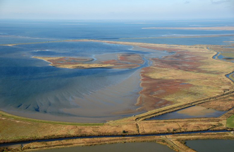
water. Eventually, the construction of the water reservoir and nature
sanctuary of Beltringharderkoog separated the Hattstedtermarsch from the
Wadden Sea in 1987.
 |
|
Beltringharderkoog.
© ALSH |
These drainage measurements opened the low lying marsh
areas for agriculture, but changed its appearance considerably. Still most
of the land there is used for stock breeding. In contrast, the consolidation
of farming scheme of Programm Nord had little impact on the ancient field
structure of the Hattstedtermarsch. Nowadays many low areas are again
designated by spatial planning as suitable for becoming wetland again,
underlining the grown importance of nature protection. Also the marshland
areas in front of Husum have retained their old fashioned field structure
with many parallel drainage ditches. 1/3 of the area of Husum is used for
agriculture, with farming mostly on the moraine fields and stock breeding
usually on the marsh land.
Recently, as agriculture becomes less and less profitable in the
Hattstedtermarsch, many fields have been taken out of agricultural use (set-aside),
receiving financial support from the state. As another option in this
respect, the cultivation of so-called renewable raw material like willow
plantings, which are cut every three years, has become fashionable but
influences the aspects of landscape much more profoundly. Even artificial
canals in the Porrenkoog have been assigned for this purpose, owed to the
obligation for renaturation of water courses according to Water Framework
Directive
4.2 Settlement development
Only few farmsteads have been added to the dispersed houses in the
Hattstedtermarsch during the last decades, especially in the formerly low
and wet eastern part. The situation on the moraine high land is dramatically
different. Small villages like Schobüll, Wobbenbüll and Hattstedt have
multiplied their size in recent decades without much regard to former
structures. The coastline of the Geest is almost closed by settlements,
which has even partially spread into the marshes. Likewise is the situation
in Husum with many development areas, especially with single, residential
houses mostly in the north of the old centre and a new and large development
area for industry and business along the regional road B5.
4.3 Industry and energy
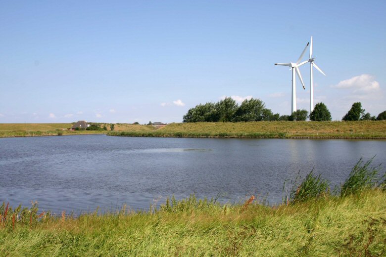
Husum has recently developed into a centre for the wind power industry,
which also requires a larger and deeper outer harbour for further growth in
connection with planned off-shore wind parks. The German army also occupies
large areas for two garrisons and a military training area, north-east of
the town. Only very few wind turbines exist in the west of Hattstedtermarsch
and in the polders along the Mühlenau River. In the area first mentioned
further construction is prohibited.
4.4 Infrastructure
The old road north to Niebüll has been extended and has been led around
Husum in order to keep through traffic away. This extension has especially
influenced the area of Hattstedtermarsch which is now virtually cut in two
by the regional road and the railway tracks. The modern outer harbour was
built and extended to cater for the need of the growing industry, at the
same time helping the old harbour to retain its historical appearance.
5. Legal and Spatial Planning Aspects
The landscape framework plan identifies many low areas as suitable for
renaturation into wetlands. Also extensive parts of the entity like areas
within Hattstedtermarsch, Porrenkoog, Dockkoog, and around Hattstedt,
Wobbenbüll and Horstedt, as well as the coast at Schobüll are designated
as possible landscape protection areas. The adjacent Beltringharderkoog is a
nature protection area. Especially the Hattstedtermarsch is, together with
the lowlands around the Arlau river, pointed out as especially significant
landscape area. The Schobüller Berg is a landscape protection area.
Some development areas already exist in the marsh land, as in the Porrenkoog
polder, but regional spatial planning has now finally recognized the
Geest-marsh land border as important for settlement development. A certain
shift in the way of thinking can also be seen in the planning for Wobbenbüll,
which confines further settlement development to the already built on area.
Spaces between Husum and Mildstedt and between Husum and Schobüll are to be
kept free from buildings.
6. Vulnerabilities
The area has especially been stressed by settlement development around Husum
during the past decades, which has substantially altered the landscape,
notably along the moraine coast around Schobüll. It has turned into almost
closed ranks of buildings. Still, new development areas are being designated.
This inevitably leads to further impact on still existing historic landscape
features and elements.
Even larger is the influence of further industrial parks, which have
extended the area of Husum, well beyond the confines of the residential and
mixed areas alone. The tendency to enhance the size of shops and malls in
these new estates, drains a lot of income from the industries and shops
inside the city, leaving them increasingly depending on the rather seasonal
tourism. Even though wind power industries are very important for the
economy of the town and region, further enhancement of the harbour bears
many dangers for the landscape and especially for the archaeological
heritage and it is therefore vital to integrate cultural heritage into the
spatial planning process thoroughly.
Concepts for the tourist development of the polder in front of Husum have
not been elaborated yet, but the potential as recreation area has been
recognized by the landscape plan which has recommended sustainable tourism
development accordingly. As detailed guidelines or objectives in this
respect are missing, this can lead to an infrastructure diminishing the
cultural landscape assets.
7. Potentials
The entity is rich in historical houses, which culminates in the impressive
and well kept old city of Husum. The old harbour is under little economic
pressure due to the construction of a new harbour closer to the sea and
therefore still depicts a rather historic status quo. This, as well as the
small scale layout of the centre of Husum is very attractive for tourism. On
the other hand, the marsh land areas of Dockkoog and Porrenkoog in front of
the town and especially the larger Hattstedtermarsch impressively display
past landscape conditions, little altered by land consolidation programs.
These sparsely settled, open areas are still mostly used for grazing and
contrast positively to the densely built area of Husum and the coast at
Schobüll. These zones have a substantial potential, not only for tourism,
but also as recreational areas for the inhabitants of Husum and its
hinterland. As the narrow, winding roads usually do not allow the use of
larger coaches, an extension of offers for bicycling, walking or guided
tours with small busses for elderly people is important. Like all marsh
landscapes, further information for visitors is also required for proper
appreciation.
Spatial planning already begins to acknowledge the threats on landscape
assets through settlement development and restricts further development
areas in the marsh land in order to retain the historical boundary between
marshes and moraines.
Economically, Husum is rather sound due to a strong position of wind power
industries and a modern harbour for industry, fishery and trade.
8. Sources
Author: Matthias Maluck
General literature:
Vollmer, et. al. (eds.) 2001. Landscape and Cultural Heritage in the Wadden Sea Region – Project Report. Wadden Sea Ecosystem No. 12.
Common Wadden Sea
Secretariat. Wilhelmshaven, Germany.
Innenministerium des Landes Schleswig-Holstein (eds.) 2004. Regionalplan für den Planungsraum V, Amendment File.
Ministerium für Umwelt, Natur und Forsten des Landes Schleswig-Holstein (eds.) 2002. Landschaftsrahmenplan für den Planungsraum V. Kiel.
Gemeinde Husum. Landschaftsplan. not published.
Gemeinde Hattstedtermarsch. Landschaftsplan. not
published.
Kunz, H. & Panten, A. 1997. Die Köge Nordfrieslands. Bredstedt.
Bantelmann, A. (ed.) 2000. Das große Nordfrieslandbuch. Bredstedt.
Johannsen, C.I. 1992. Eine reiche Hauslandschaft in ‚Nordfriesland’, no. 97. Bredstedt.
Gemeinsames Wattenmeer Sekretariat (ed.) 2005. Das Wattenmeer. Theiss Verlag Stuttgart.
Arbeitsgemeinschaft Chronik der Hattstedtermarsch (Eds.).
1985 Chronik der Hattstedtermarsch. Bredstedt
Maps:
Archaeological monument record of Schleswig-Holstein and gis mapping
Lancewad data base and gis maps
Royal Prussian ordnance survey of 1879
|